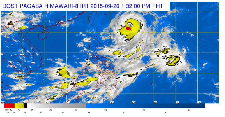
This satellite image from Pagasa shows the location of Typhoon Jenny as of 1:32 p.m. on Saturday
Typhoon “Jenny” (international name: Dujuan) has intensified as it makes its way out of the Philippine area of responsibility (PAR), the state weather bureau said Saturday.
The Philippine Atmospheric, Geophysical and Astronomical Services Administration (Pagasa) in its 11 a.m. weather bulletin said Jenny has maximum sustained winds of 140 kilometers per hour (kph) near the center and gustiness of up to 170 kph.
The eye of the typhoon was located 860 kilometers east of Itbayat, Batanes as of 10 a.m. It continues to move northwest at 13 kph, up from 11 kph on Friday evening.
Although it has not made landfall in the country, it continued to enhance the southwest monsoon (“habagat”), which is expected to bring moderate to heavy rains over Palawan, Western Visayas and Zamboanga peninsula.
Jenny is expected to leave PAR by Tuesday morning.
Fishermen near the eastern seaboards of Southern Luzon, Visayas and Mindanao are advised not to venture out into the sea.
No public storm warning signal has been raised.
RELATED STORIES
‘Jenny’ intensifies into typhoon
‘Jenny’ intensifies as it heads northwest