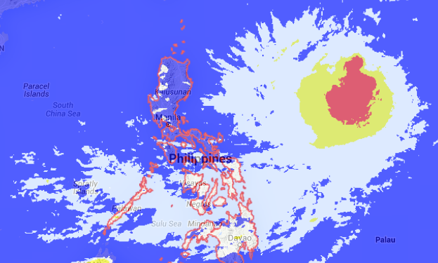
Satellite Image-6:35 PM–September 23. SCREENGRAB from noah.dost.gov.ph
Tropical Storm “Jenny” (international name: Dujuan) entered the Philippine area of responsibility on Wednesday afternoon, the state weather bureau said.
Jenny entered PAR sooner than expected due to its speed of 15 kilometers per hour west northwest from 9 kph of the same direction at noontime, Samuel Duran of the Philippine Atmospheric, Geophysical and Astronomical Services Administration said.
Duran said the tropical storm was 1,465 km east of Luzon as of 4 p.m. and was at PAR at around 5 p.m.
Jenny packed maximum sustained winds of 65 kph.
Although it is not expected to make landfall, Jenny will enhance the southwest monsoon or hanging habagat.
“It will affect Western Visayas, Mimaropa, and possibly Metro Manila by weekend,” Duran said. Frances Mangosing/RC
RELATED STORIES
Tropical storm ‘Dujuan’ expected to enter PAR Wednesday night
Tropical depression may spare PH–Pagasa