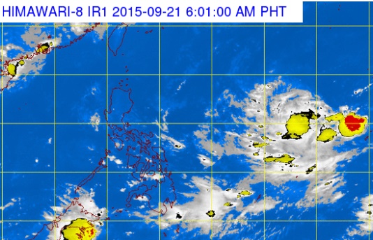
A tropical depression appears on on the right middle part a Pagasa satellite photo taken Monday morning. The tropical depression will be called ‘Jenny’ if it enters the Philippine area of responsibility. PAGASA WEBSITE SCREENGRAB
The state weather bureau is tracking a tropical depression that may enter the Philippine area of responsibility (PAR) on Wednesday.
The weather disturbance was last seen 2,400 kilometers east of Luzon, weather forecaster Aldczar Aurelio of the Philippine Atmospheric, Geophysical and Astronomical Services Administration (Pagasa) said.
Once it enters PAR, it will be locally named “Jenny.”
Aurelio could not immediately say how the tropical cyclone would affect the country in the coming days.
Meanwhile, an intertropical convergence zone—a breeding ground for potential cyclones—is affecting the Visayas and Mindanao.
Cloudy skies with light to moderate rain and isolated thunderstorms will be experienced over the Western Visayas, Caraga, SOCCSKSARGEN and Davao Region, Pagasa said.
In Metro Manila and the rest of the country, there will be partly cloudy to cloudy skies with isolated thunderstorms.