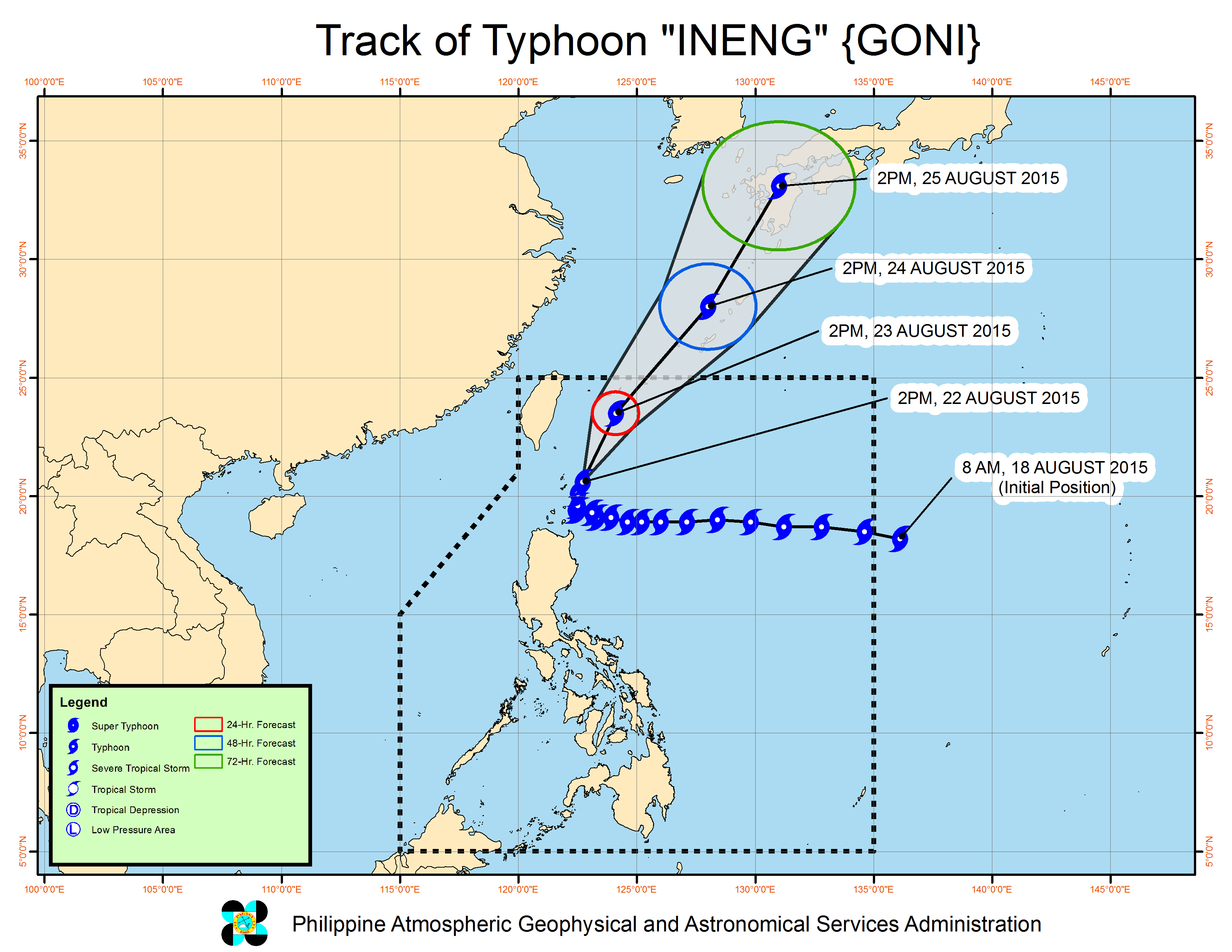
Typhoon Ineng (Goni) has weakened as it moved north-northeast on Saturday, the state weather bureau said.
Ineng packed maximum sustained winds of 150 kilometers per hour near the center and gusts of up to 185 kph, the Philippine Atmospheric Geophysical and Astronomical Services Administration said.
It would still bring moderate to heavy rains within its 500 kilometer diameter, however.
Signal No. 3 was hoisted over Batanes Group of Islands, while Signal No. 1 was raised over Northern Cagayan including Calayan and Babuyan Group of Islands. The rest of Cagayan, Apayao, Ilocos Norte, Kalinga and Abra were placed under Signal No. 1.
Monsoon rains are forecast over Metro Manila and the rest of Luzon.
Fishermen were warned not to venture out over the seaboards of Metro Manila, Isabela, Ilocos Sur, Pangasinan and La Union, as well as the seaboards of Central and Southern Luzon.
Ineng, which moved 13 kph north-northeast, is expected to exit the Philippine area of responsibility by Monday afternoon.
Pagasa said Ineng was last observed 105 kilometers east of Basco, Batanes. JE