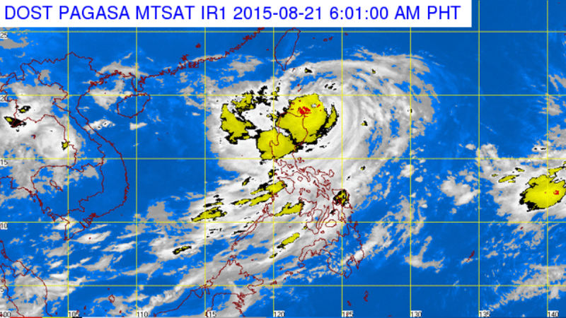
The typhoon moved west northwest at 7 kilometers per hour (from 11 kph on Thursday afternoon) and is expected to exit the Philippine area of responsibility by Tuesday evening, the Philippine Atmospheric, Geophysical and Astronomical Services Administration (Pagasa) said.
Ineng’s strength remained unchanged in the past several hours, with maximum sustained winds of 170 kilometers per hour and gusts of up to 205 kph.
Although it is not seen to make a landfall, weather forecasters earlier said Ineng would be closest to Batanes on Friday evening.
Public Storm Warning Signal No. 3 remained hoisted over the Batanes Group of Islands and northern Cagayan including Babuyan and Calayan Group of Islands.
The rest of Cagayan, northern Isabela, Kalinga, Apayao, Abra and Ilocos Norte also remained under Signal No. 2.
Signal No. 1 remained hoisted over the rest of Isabela, Ifugao, Mt. Province, Benguet, La Union and Ilocos Sur but was lifted in northern Aurora, Quirino and Nueva Vizcaya.
All the affected areas will be prone to flashfloods, landslides and storm surges, Pagasa warned.
Ineng will continue to bring monsoon rains over Central Luzon and occasional rains over Metro Manila, Calabarzon, Mimaropa and Western Visayas, Pagasa added. Frances Mangosing/INQUIRER.net