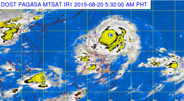
MT Satellite image August 20, 2015, 5:32 a.m. Screengrab from https://www.pagasa.dost.gov.ph/
Parts of extreme Northern Luzon will have stormy weather as Typhoon “Ineng” (international name: Goni) moves closer, the state weather bureau said Thursday.
Signal No. 2 remained hoisted over the Batanes Group of Islands and Cagayan including Calayan and Babuyan Group of Islands, the Philippine Atmospheric Geophysical and Astronomical Services Administration (Pagasa) said.
Rains with gusty winds are expected over the affected areas.
Pagasa also warned those under Signal No. 2 of possible storm surges in coastal areas.
Signal No. 1 was hoisted over northern Aurora, Ifugao, Isabela, Mt. Province, Kalinga, Apayao, Abra and Ilocos Norte.
Ineng will also enhance “hanging habagat,” or southwest monsoon, and bring occasional rains over the western section of Luzon including Metro Manila and the Visayas.
Pagasa also warned of risky sea travel over the eastern seaboard of Luzon and Visayas.
Ineng further slowed down early Thursday, with a speed of 13 kilometers per hour.
The typhoon maintained its maximum sustained winds of 18 kilometers per hour near the center and gusts of up to 215 kph.
Ineng was last observed 445 km east of Calayan, Cagayan and is expected to exit the Philippine area of responsibility by Monday morning.