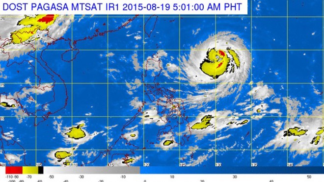
Two weeks after it was battered by the super-howler “Hanna,” the northernmost island province of Batanes will likely suffer a direct hit again from another powerful typhoon on Friday, the weather bureau has warned.
Typhoon “Ineng” (international name: Goni), which formed over the Pacific Ocean last Friday, entered the Philippine area of responsibility at noon on Tuesday, according to the Philippine Atmospheric, Geophysical and Astronomical Services Administration (Pagasa).
Packing maximum sustained winds of 170 kilometers per hour and gusts up to 205 kph, Ineng is headed west-northwest toward extreme northern Luzon at 25 kph.
“If it maintains its track, it will possibly make landfall over Batanes by Friday,” said Pagasa meteorologist Gener Quitlong.
He said the typhoon will enhance the prevailing southwest monsoon and bring rain over most of Luzon, including Metro Manila, as well as the Visayas and Mindanao, beginning Thursday or Friday, lasting to Monday or Tuesday next week.
The rains being experienced in the Visayas and Mindanao and the occasional thunderstorms in the rest of the country are caused not by the typhoon but by the southwest monsoon, Pagasa said.
The typhoon is expected to exit the Philippine area of responsibility by Saturday, on its way to Taiwan or southeastern China.
Typhoon Hanna (international name: Soudelor), which had close to supertyphoon strength (220 kph maximum winds), battered extreme northern Luzon two weeks ago although it did not make landfall.
