Typhoon Ineng might make landfall in Batanes on Friday
Typhoon Ineng
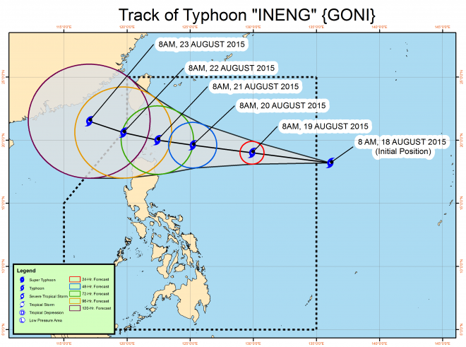
The state weather bureau said there is a possibility that Typhoon Ineng (Goni) will make landfall over Batanes on Friday.
“Our forecast models show that it is likely that Ineng will make landfall. So far that is our priority scenario,” said weather forecaster Jori Loiz by phone on Tuesday.
However, he said they are not discounting the possibility that the typhoon will re-curve and head outside PAR.
Ineng may also intensify in the next two to three days, but it is still far from being a supertyphoon.
The typhoon-packed maximum sustained winds of 175 kilometers per hour near the center and gusts of up to 205 kph.
Article continues after this advertisementIt was last located 1,305 kilometers east of Aparri in Cagayan and continued to move west northwest at 25 kph.
Article continues after this advertisementMetro Manila may experience rains from monsoon rains enhanced by Ineng starting Thursday or Friday, Loiz said.
Ineng will also enhance the southwest monsoon in Palawan, Visayas and Mindanao.
Cloudy skies with light to moderate rains and isolated thunderstorms will be experienced over Visayas, Zamboanga Peninsula, Northern Mindanao, Caraga and the province of Palawan.
Partly cloudy to cloudy skies with isolated thunderstorms will prevail over Metro Manila and the rest of the country. TVJ
RELATED STORY