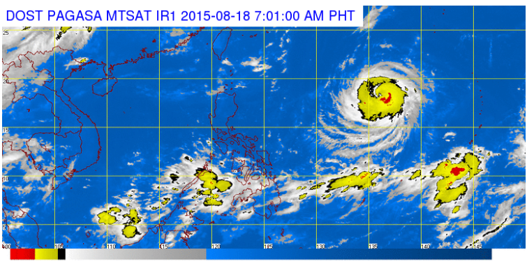
This satellite image from Pagasa shows the locations of Typhoon Goni (to be named Ineng when it enters PAR) and the ITCZ.
Typhoon “Goni” (international name), located east of Luzon, may enter the Philippine area of responsibility (PAR) Tuesday afternoon.
The typhoon, which will be locally named “Ineng” when it enters PAR, packed maximum sustained winds of 170 kilometers per hour and gusts of up to 205 kph, the Philippine Atmospheric, Geophysical and Astronomical Services Administration said.
Goni moved swiftly at 25 kph west northwest.
READ: ‘Ineng’ to enter PAR Tuesday afternoon, bring more rain | Lumalakas na Tropical Storm Goni (Ineng), papasok sa PAR sa Martes (Aug.18)
Although it is still too far to directly affect the country, rains will be experienced due to the intertropical convergence zone (ITCZ) affecting Visayas and Palawan.
Light to moderate rains and isolated thunderstorms are forecast over Visayas and Palawan, Pagasa said.
Metro Manila and the rest of the country will have partly cloudy to cloudy skies with isolated thunderstorms.
Moderate to occasionally strong winds blowing from the southwest to west will prevail over Mindanao and its coastal waters will be moderate to occasionally rough.
Elsewhere, winds will be light to moderate coming from the northwest to west with slight to moderate seas. IDL