Typhoon to enter PAR Tuesday—Pagasa
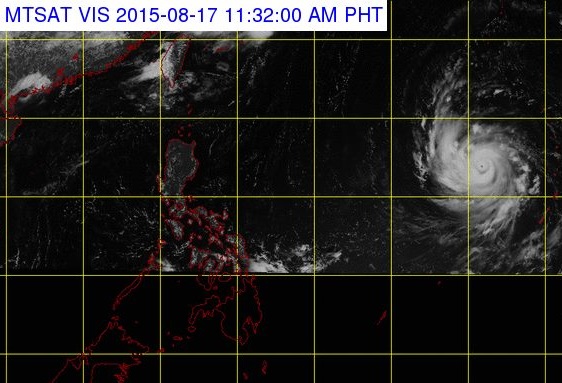
A satellite photo provided by Pagasa shows Typhoon Goni east of Luzon. Pagasa expects the typhoon to enter the Par on Tuesday afternoon, August 18. PAGASA WEBSITE SCREENGRAB
A typhoon will enter the Philippine area of responsibility (Par) Tuesday but will not yet affect the country, the weather bureau said Monday.
As of 10 a.m, the typhoon with international name “Goni” was 2,050 kilometers east of Central Luzon, said the Philippine Atmosepheric, Geophysical and Astronomical Services Administration (Pagasa).
Pagasa said Goni was packing maximum winds of 140 kph and gustiness of up to 170 kph
At its speed of 20 kph and west northwest track, Goni is expected to cross the Par Tuesday afternoon. By then, it would be called locally as “Ineng.”
According to Pagasa, it would still have no direct effect on any part of the country until Friday or Saturday, when it nears Northern Luzon.
Article continues after this advertisementThe weather bureau advised the public to monitor succeeding weather bulletins for updates on the typhoon’s movement.
Clouds and rain currently over the archipelago are due to the intertropical convergence zone which is mostly affecting the Visayas and Mindanao. CB