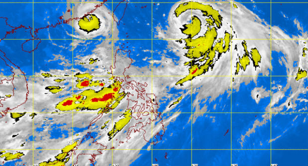
Typhoon “Falcon” will bring more monsoon rains to Luzon, including Metro Manila, and Western Visayas, the state weather bureau said early Thursday.
“Monsoon rains which may trigger flashfloods and landslides will be experienced over Metro Manila, the regions of Ilocos, Cordillera, Central Luzon, Calabarzon and Mimaropa,” the Philippine Atmospheric Geophysical and Astronomical Services Administration said in its weather bulletin issued at 5 a.m. on Thursday.
It said the rest of Luzon, Western and Central Visayas will have occasional rains while the rest of the country will be partly cloudy to cloudy with isolated thunderstorms.
Falcon was last observed 885 kilometers east northeast of Itbayat, Batanes. It packed maximum sustained winds of 130 kilometers per hour near the center and gusts of up to 160 kph.
The typhoon continued to move west northwestward at the speed of 20 kph, Pagasa said, adding it is expected to exit the country on Friday.
Rainfall warnings
The weather bureau also issued rainfall warnings in parts of Luzon due to the southwest monsoon enhanced by Falcon.
As of 5a.m., Cavite and Batangas were placed under Orange rainfall alert, which means intense rain (15 to 30 millimeters/hour) may cause flooding and residents should be on alert for possible evacuation.
A yellow rainfall alert (7.5-15 mm/hour) was hoisted over Metro Manila, Laguna, Bataan and Rizal, where flooding is possible in low-lying areas due to heavy rain.
Light to moderate rain, according to Pagasa, was affecting Quezon, Zambales, Tarlac, Nueva Ecija, Pampanga and Bulacan and this was expected to persist for three hours.
