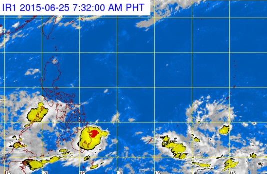
Pagasa said Wednesday, June 25, 2015, that it was watching a cluster of clouds (bottom, right) which could develop into a low pressure area and a potential typhoon. PAGASA WEBSITE SCREENGRAB
Amid the onset of the rainy season, the weather bureau said Wednesday it was monitoring a cloud cluster east of Mindanao over the Pacific Ocean that could develop into a low pressure area (LPA).
LPAs may form into storms or typhoons, which have caused severe damage to the Philippines over the past few years.
On Tuesday, the Philippine Atmospheric, Geophysical and Astronomical Services Administration (Pagasa) said it expected 11 to 16 typhoons to hit the country before the end of 2015. Up to two storms are seen in June.
Meanwhile, Mimaropa, the Visayas and Mindanao will have cloudy skies with light to moderate rain on Thursday due to an intertropical convergence zone, Pagasa said.
Partly cloudy to cloudy skies with isolated rainshowers or thunderstorms will prevail over Metro Manila and the rest of the country, it added.
Moderate to occasionally strong winds blowing from the southwest to the south will prevail over the western section of Luzon, where coastal waters will be moderate to occasionally rough.
Winds will be light to moderate coming from the southwest going to south over the rest of Luzon and from the southwest to west over the rest of the country with slight to moderate seas.