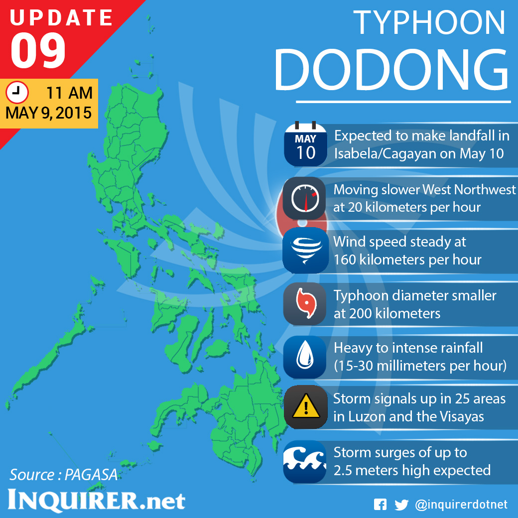
Typhoon Dodong (international name “Noul”) maintained its strength as storm signal no. 3 was hoisted in three areas, the state weather bureau said Saturday.
Packing maximum sustained winds of 160 kph near the center and gustiness of up to 195 kph, it slowed down and continues to move west northwest at 20 kilometers per hour (20 kph).
In its 11 a.m. bulletin, the Philippine Atmospheric, Geophysical and Astronomical Services Administration (Pagasa) said heavy to intense rains are expected within the 200-kilometer diameter of the typhoon.
The eye of the typhoon was located 210 kilometers northeast of Virac, Catanduanes or 460 east of Infanta, Quezon at 10 a.m. Saturday.
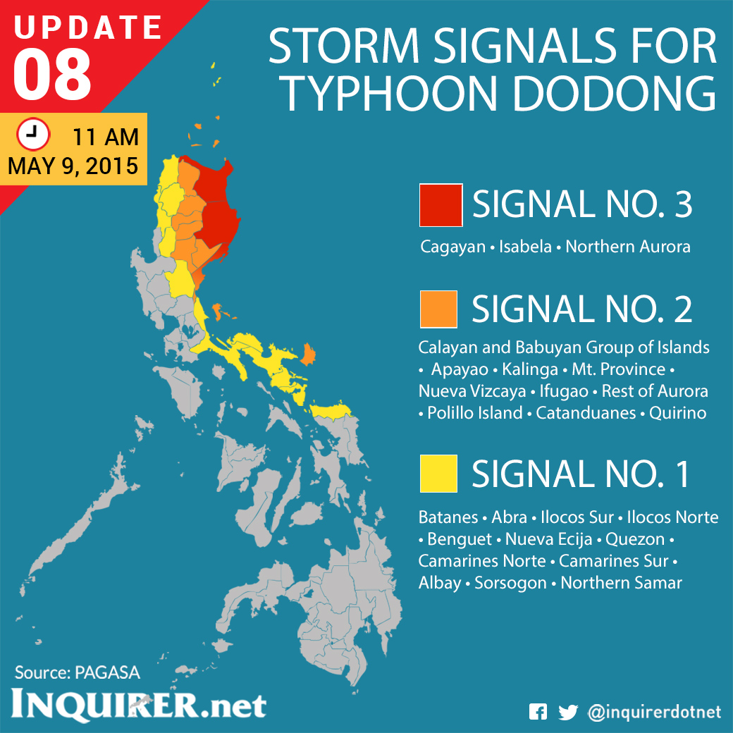
Public Storm Warning Signal no. 3 was raised in Cagayan, Isabela, and northern Aurora.
Meanwhile, signal no. 2 was raised in Calayan and Babuyan Group of Islands, Apayao, Kalinga, Mt. Province, Nueva Vizcaya, Ifugao, Rest of Aurora, Polillo Island, Catanduanes, and Quirino.
Signal no. 1 is up in Batanes, Abra, Ilocos Sur, Ilocos Norte, Benguet, Nueva Ecija, Quezon, Camarines Norte, Camarines Sur, Albay, Sorsogon, and Northern Samar.
Dodong is expected to make landfall over the Isabela-Cagayan area on Sunday and is supposed to exit the Philippine Area of Responsibility Monday evening.
Pagasa said possible flashfloods and landslides should be expected in areas where storm signals are raised. Storm surge of up to 2.5 meters may also occur along the eastern coast of Camarines Sur, Quezon, and Isabela.
Cloudy skies and light to moderate rains are expected in Metro Manila. KS