

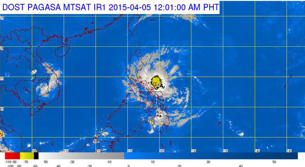
Pagasa satellite image as of 12:01AM | Sunday, April 5, 2015
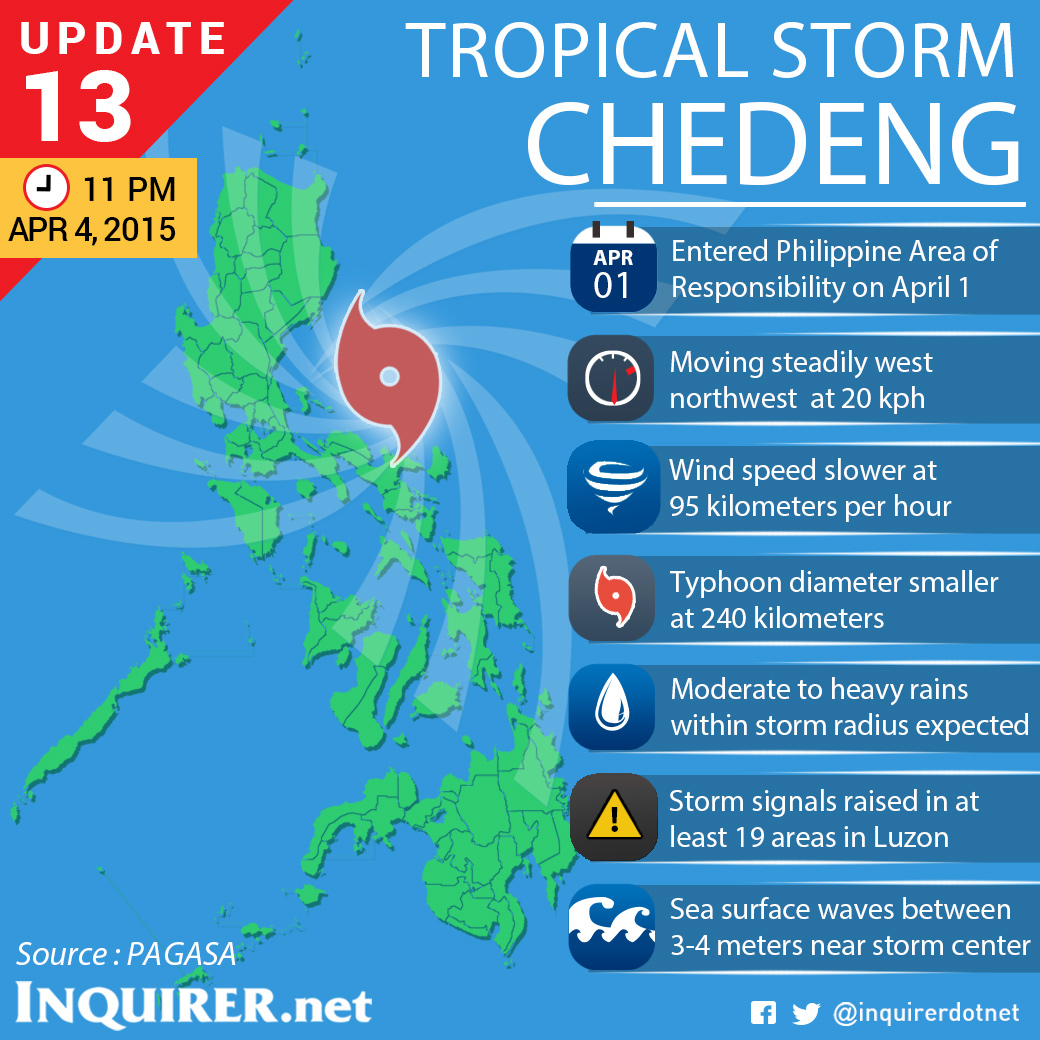
MANILA, Philippines–Tropical Storm “Chedeng” (international name: Maysak) has weakened further as it gets closest to its landfall, the weather bureau said Saturday late evening.
In its bulletin, the Philippine Atmospheric, Geophysical and Astronomical Services Administration said “Chedeng” has maximum sustained winds of 95 kilometers per hour and gusts of up to 120 kph.
“Chedeng” last clocked in wind speeds of 115 kph near the center and gusts of 145 kph in Pagasa’s 5 pm forecast.
Pagasa added that “Chedeng” was last spotted 220 kilometers southeast of Casiguran, Aurora and tracking a west northwest path at 20 kph.
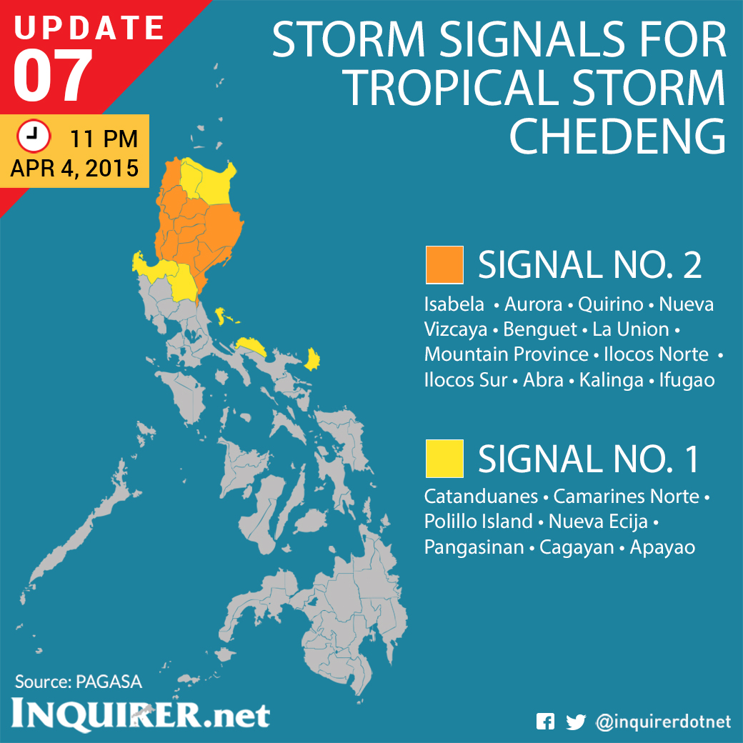
Isabela, Aurora, Quirino, Nueva Vizcaya, Buenget, La Union, Mountain Province, Ilocos Sur, Abra, Kalinga, Ilocos Norte, and Ifugao are under public storm warning signal no. 2.
Catanduanes, Camarines Norte, Polillo Island, Nueva Ecija, Pangasinan, Cagayan, and Apayao are under public storm warning signal no. 1. TVJ
RELATED STORIES
‘Chedeng’ to be felt Saturday night; Signal No. 2 up in 10 provinces
24,000 to be evacuated as ‘Chedeng’ closes in on PH