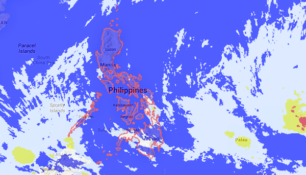
MANILA, Philippines—The low pressure area monitored by the state weather bureau seen to enter Wednesday night or Thursday has intensified into a tropical depression.
The Philippine Atmospheric Geophysical and Astronomical Services Administration said on Tuesday afternoon that the tropical depression outside the Philippine area of responsibility was last observed 1,690 kilometers east of Mindanao with maximum winds of 55 kilometers per hour.
It was moving west at 19 kph.
Once it enters the PAR, it will be locally named “Amang.”
The weather disturbance comes on the heels of Tropical Storm “Seniang” and Typhoon “Ruby” which devastated the Visayas and Mindanao a couple of weeks apart in December.
The weather bureau’s forecast has indicated the possibility the cyclone would not hit land in the Visayas or Mindanao, but will curve northward while remaining at sea.
But Pagasa forecasters stressed the weather could change during the week as the LPA approaches the Philippine area of responsibility.
In a special weather outlook for Metro Manila and Tacloban City issued ahead of Pope Francis’ visit, Pagasa warned of rain during the Pontiff’s visits to these two places.
Pagasa said that on Jan. 18 when Pope Francis holds a Mass at Rizal Park, Metro Manila could expect “moderate to heavy rains and moderate to occasionally strong winds” as the tropical cyclone moves closer to the eastern section of southern Luzon.
By Jan. 19, Pagasa said Metro Manila would have light to moderate rains and moderate winds “as the weather disturbance is expected to move north then recurve to the northeast.”
During Pope Francis’ visit on Jan. 17 to Tacloban City and the nearby town of Palo, expect “light to moderate rainshowers, moderate to strong winds and likely thunderstorms” as the expected tropical cyclone moves closer to the area.
By Jan. 18, Leyte will have cloudy skies and by Jan. 19, the area will have generally good weather, Pagasa said.
RELATED STORIES
Rains threaten to mar Pope’s visit, Pagasa warns
