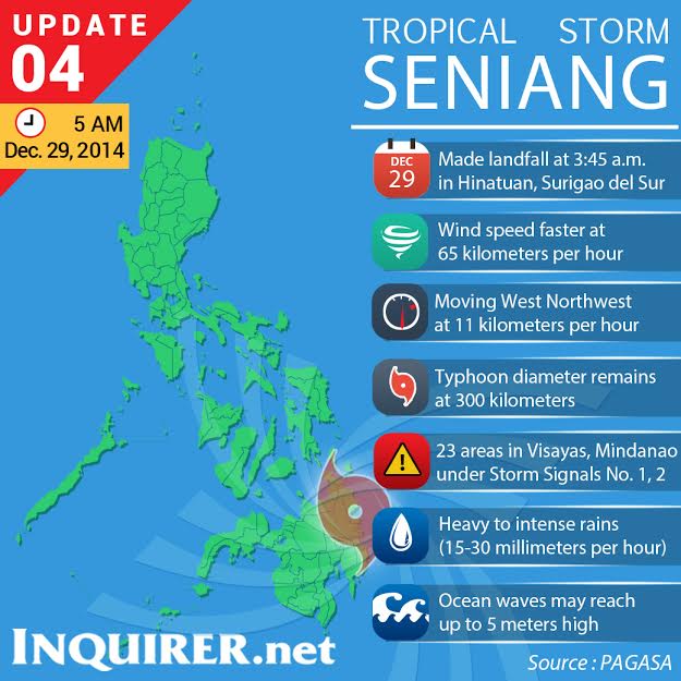
MANILA, Philippines – Seniang intensified overnight and was declared a tropical storm Monday as it made landfall over Hinatuan, Surigao del Sur.
Packing winds of 65 kilometers per hour and gusts of up to 80 kph, Seniang dumped moderate to intense rain within its 300 km diameter, said the Philippine Atmospheric, Geophysical and Astronomical Services Administration (Pagasa) in its 5 a.m. bulletin.
Subsequently, Pagasa raised storm public warning signal number 2 over Bohol and Siquijor in the Visayas, and Surigao del Sur, Surigao del Norte, Siargao Island, Agusan del Norte, Agusan del Sur, Misamis Oriental and Camiguin in northeastern Mindanao.
According to Pagasa, areas under signal number 2 can expect destruction of rice and corn plants, uprooting of some large trees, blowing away of roof made of nipa or galvanized iron and the rolling off of billboards and signages.
Meanwhile, signal number 1 was raised over Leyte, Southern Leyte, Camotes Island, Cebu, Negros Oriental and Negros Occidental in the Visayas.
In Mindanao, signal number 1 was hoisted over Dinagat Province, Compostela Valley, northern Davao Oriental, Davao del Norte, Bukidnon, Lanao del Norte, Misamis Occidental and Zamboanga del Norte.
Residents in these provinces may experience moderate to heavy rain, slight damage on trees and plants, and some roofing may be torn away, according to Pagasa.
Due to the heavy rainfall, Pagasa warned of possible flashfloods and landslides and advised residents of low-lying and mountainous areas to be on alert.
The weather bureau said travel in waters under signal number 2 are risky for all types of sea craft since waves could reach up to five meters high, while small vessels are cautioned against sailing in waters under signal number 1.
RELATED STORIES
Seniang moves north, to landfall over Tandag
‘Seniang’ raises fears of floods, slides in South
