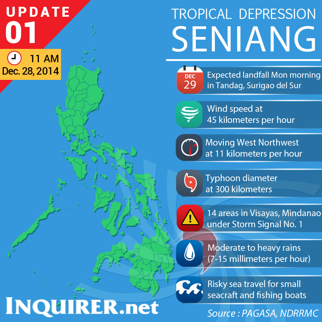
MANILA, Philippines–Tropical depression “Seniang” is expected to make its first landfall over Tandag, Surigao del Sur, on Monday morning as it maintained strength and continued to move closer to northeastern Mindanao, the state weather bureau said Sunday.
The Philippine Atmospheric, Geophysical Astronomical Services Administration (Pagasa) said Seniang would make landfall 100 kilometers north of Hinatuan, Surigao del Sur, as it moved west northwest at 11 kilometers per hour.
The estimated amount of rainfall is 7 to 15 millimeters per hour.
For the next three days, Seniang is forecast to be in the following areas:
* In the next 48 hours (Tuesday morning), 30 km west of Tagbilaran City, Bohol.
* In the next 72 hours (Wednesday morning), 230 km west of Dumagete City, Negros Oriental, or 280 km east of Puerto Princesa City.
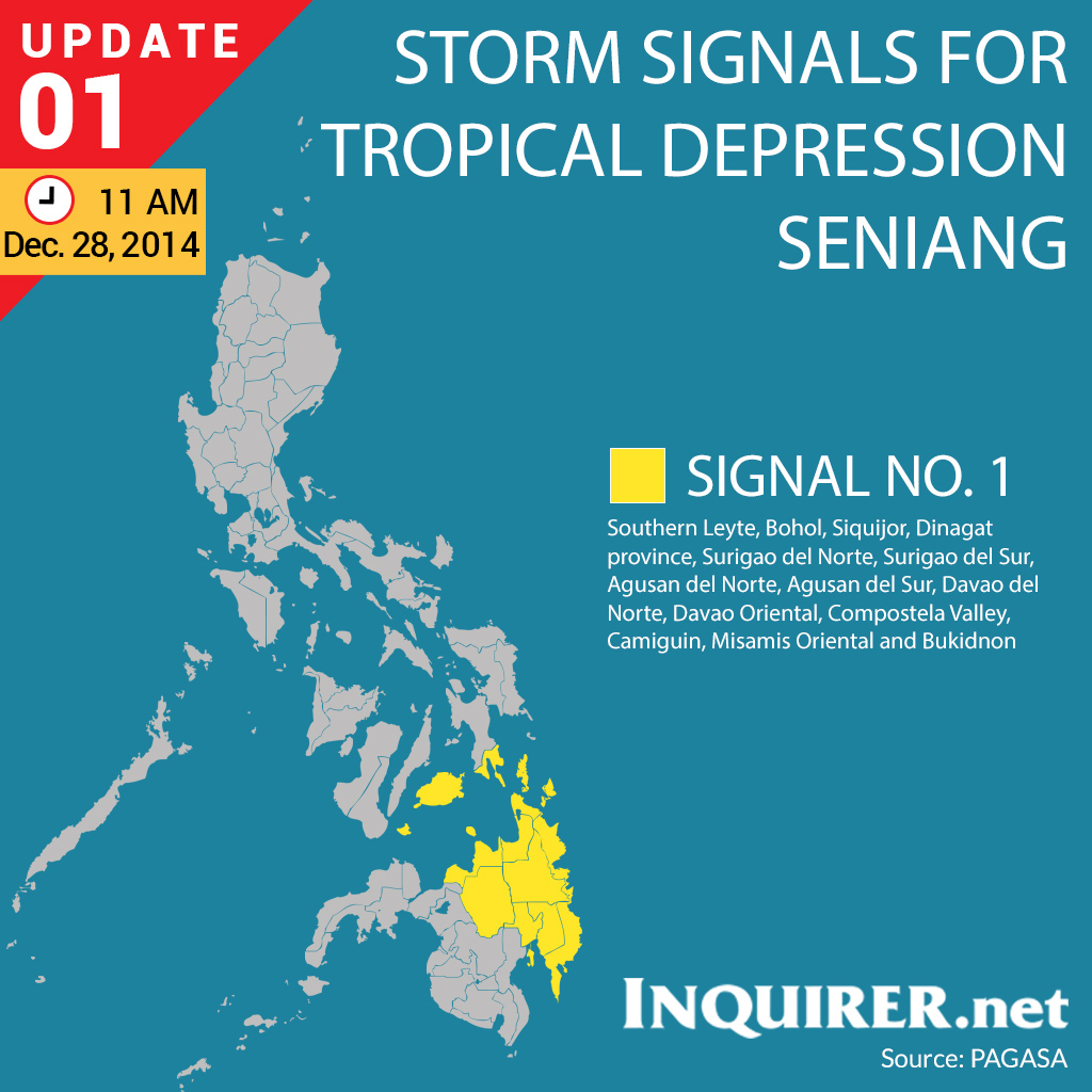
Public storm warning signal no. 1 has been raised over Surigao del Norte, Surigao del Sur, Agusan del Norte, Agusan del Sur, Davao del Norte, Davao Oriental, Compostela Valley, Camiguin Island, Misamis Oriental and Bukidnon.
Signal no. 1 has also been raised over Dinagat Province, Southern Leyte, Bohol and Siquijor in the Visayas.
The weather bureau warned residents in low-lying and mountainous areas of Eastern Visayas and Mindanao, especially the Caraga Region, to prepare for possible flash floods and landslides.
RELATED STORY
LPA now depression ‘Seniang’—Pagasa