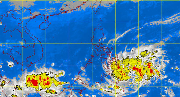
MT Satellite image December 28, 2014 7:32 a.m. Screengrab from https://pagasa.dost.gov.ph
MANILA, Philippines — The low pressure area (LPA) east of Hinatuan, Surigao del Sur, has developed into a tropical depression and was named “Seniang.”
Seniang is expected to landfall over Hinatuan on Monday morning and bring occasional moderate to heavy rainfall over Eastern Visayas and Mindanao, said the Philippine Atmospheric Geophysical and Astronomical Services Administration (Pagasa).
Public storm warning signal no. 1 was raised in Surigao del Norte, Surigao del Sur, Agusan del Norte, Agusan del Sur, Davao del Norte, Davao Oriental, Compostella Valley, Camiguin Island, Misamis Oriental and Bukidnon, which are expected to experience winds of 30 to 60 kilometers per hour in at least 36 hours.
In its 5 a.m. bulletin released Sunday, Pagasa warned residents of low-lying and mountainous areas in affected provinces against possible flashfloods and landslides.
Fisher folk and small sea craft were advised not to venture off into the eastern seaboards of the Visayas and Mindanao as strong to gale force winds are expected to stir up rough waters in these areas.
The tail-end of a cold front is affecting the Bicol Region while the northeast monsoon (amihan) is affecting Northern and Central Luzon.
RELATED STORIES
LPA to continue to bring rains in parts of Visayas, Mindanao – Pagasa
New storm to be named ‘Seniang’