

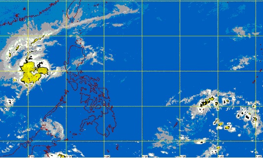
Pagasa’s satellite photo released December 11, 2014, Thursday, shows Ruby (left) leaving the Philippine area of responsibility. At right is a low pressure area that Pagasa says may develop into a new typhoon.
MANILA, Philippines – The weather bureau said Thursday that if the low pressure area (LPA) east of Mindanao becomes a storm and enters the Philippine area of responsibility (PAR), it will be named “Seniang.”
The LPA may enter the PAR late Thursday or early Friday, according to the Philippine Atmospheric, Geophysical and Astronomical Services Administration (Pagasa).
It was last spotted 1,500 kilometers east of Mindanao.
Weather forecaster Aldczar Aurelio said the LPA developed in the same area as Ruby (International name Hagupit), which exited the PAR Wednesday night at 10p.m.
Like Ruby, the LPA could intensify and become a storm as it remained over water.
In the meantime, Pagasa said the northeast monsoon or amihan would bring cloudy skies with light rains to the regions of Cagayan Valley, the Cordilleras and Ilocos.
Metro Manila and the rest of the country will have partly cloudy to cloudy skies with isolated rains or thunderstorms.
Moderate to strong winds from the northeast will prevail over Luzon and the eastern section of the Visayas and the coastal waters along these areas will be moderate to rough. Elsewhere, winds will be light to moderate, Pagasa said.
RELATED STORIES
Netizens capture Typhoon Ruby’s wrath
Potential typhoon brewing in Ruby’s wake
