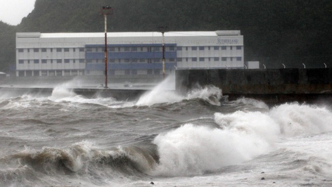
Strong waves from Typhoon Hagupit hit the shores of Legazpi, Albay province, eastern Philippines on Sunday, Dec. 7, 2014. Typhoon Hagupit knocked out power in entire coastal provinces, mowed down trees and sent more than 650,000 people into shelters before it weakened Sunday, sparing the central Philippines a repetition of unprecedented devastation by last year’s storm. (AP Photo/Aaron Favila)
MANILA, Philippines—Typhoon “Ruby” (international name: Hagupit) has slightly weakened as it traversed the Sibuyan Sea, now packing maximum sustained winds of 120 kilometers per hour (kph) from 140 kph and gusts of up to 150 kph from 170 kph, the state weather bureau said Monday morning.
Jori Loiz, weather forecaster of the Philippine Atmospheric Geophysical and Astronomical Administration (Pagasa), in its 5 a.m weather bulletin, warned that people should remain vigilant despite Ruby’s weakened intensity.
Loiz said that Metro Manila will feel Ruby’s wrath from 6 to 8 p.m. on Monday.
Signal No. 3 was hoisted over Burias, Marinduque, Romblon, Occidental Mindoro, Oriental Mindoro, Batangas, Laguna, Cavite, Southern Quezon and Lubang Island.
Signal No. 2 was raised over Masbate, Ticao Island, Calamian Group of Islands, Bulacan, Bataan, Northern Quezon, Rizal, Metro Manila, Camarines Sur, Camarines Norte, Semirara Island, Aklan and Capiz.
Meanwhile, Biliran, Bantayan Island, Zambales, Sorsogon, Albay, Polilio Island,Nueva Ecija, Tarlac, Pampanga, Catanduanes, Northern Palawan, Cuyo, Northern Samar, Iloilo and Antique were placed under Signal No. 1.
The typhoon maintains its sluggish pace of 10 kph in a west northwest direction and is expected to make its third landfall in the vicinity of Northern Mindoro between 6 to 8 p.m. on Monday, bringing moderate to heavy rains within its 450 km diameter.
As of 4 a.m. Monday, Ruby was last seen at 110 km northwest of Masbate City.
RELATED STORIES
Typhoon ‘Ruby’ heads to Mindoro; Signal No. 2 up in Metro Manila
Metro Manila feels ‘Ruby’ Monday