‘Ruby’ maintains strength; Signal No. 2 up in 11 areas
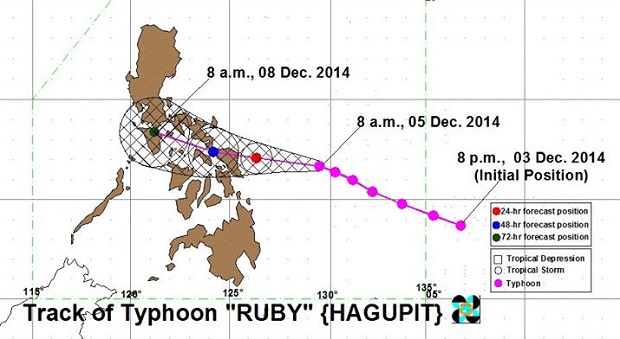
Track of Typhoon Ruby. Photo from Dost_pagasa’s facebook page
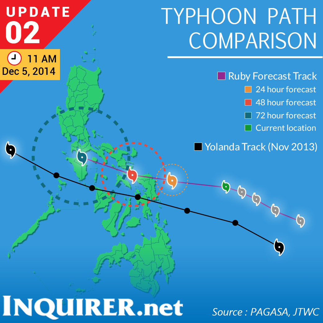
MANILA, Philippines — Typhoon “Ruby” (international name: Hagupit) maintained its strength as it continued to track the Eastern Samar-Northern Samar area midday Friday.
The Philippine Atmospheric, Geophysical and Astronomical Services Administration (Pagasa) said Ruby packed maximum sustained winds of 215 kilometers per hour near the center and gusts of up to 250 kph.
 It was last located 435 kilometers east of Borongan in eastern Samar and moved west northwest at 13 kph.
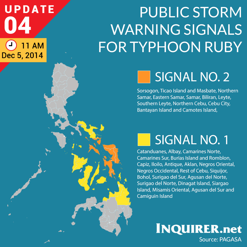
Signal No. 2 (Winds of 61-100 kph is expected in at least 24 hrs) was raised in the following areas:
LUZON: Sorsogon, Ticao Island and Masbate
VISAYAS: Northern Samar, Eastern Samar, Samar, Biliran, Leyte, Southern Leyte, Northern Cebu including Cebu City, Bantayan Island and Camotes Island
Some of its effects include:
- Rice and corn may be adversely affected
- Few large trees uprooted
- Large number of nipa and cogon houses partially or totally unroofed and old galvanized iron roofs may roll off.
- Billboards/Signage may roll off
- Travel by all types of sea vessels and aircraft are risky
Residents in low lying and mountainous areas are alerted against possible flashfloods and landslides.
Signal No. 1 (Winds of 30-60 kph is expected in at least 36 hrs) was hoisted in the following areas:
LUZON: Catanduanes, Albay, Camarines Norte, Camarines Sur, Burias Island and Romblon
VISAYAS: Capiz, Iloilo, Antique, Aklan, Negros Oriental, Negros Occidental, Rest of Cebu, Siquijor and Bohol
MINDANAO: Surigao del Sur, Agusan del Norte, Surigao del Norte, Dinagat Island, Siargao Island, Misamis Oriental, Agusan del Sur and Camiguin Island
Some of its effects include:
- Twigs and branches of trees may be broken
- Some banana plants may tilt or land flat on the ground
- Rice in flowering stage may suffer significant damage
- Some nipa and cogon houses maybe partially unroofed
- Sea travel of small sea craft and fishing boats is risky
These areas will have occasional rains with occasional gusty winds.
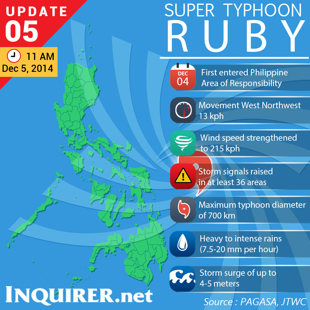 Ruby is expected to make landfall over Eastern Samar- Northern Samar area and it will be associated with strong winds, storm surge of 4-5 meters and heavy to intense rainfall.
Heavy to intense rains of 7.5 – 20 mm per hour within its 700 kilometer-diameter are expected.
Ruby and the northeast monsoon will bring rough to very rough sea conditions over the seaboards of Northern Luzon, eastern seaboard of Central and Southern Luzon, seaboards of Visayas and over northern and eastern seaboards of Mindanao.
Fisherfolks and those using small sea craft are advised not to venture out over the said seaboards.
Ruby is expected to exit the Philippine area of responsibility on Wednesday morning.
RELATED STORIES