Tropical depression Queenie has maintained its strength as it crosses southern Visayas on Thursday.
Queenie still packs maximum sustained winds of 55 kilometers per hour near the center and is moving west northwest of 24 kph, the Philippine Atmospheric Geophysical and Astronomical Services Administration (Pagasa) has said.
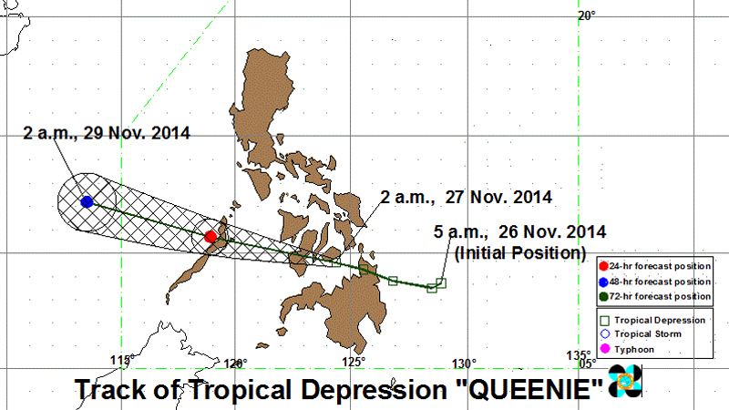
At 4 a.m. Thursday, it was observed near Tagbilaran City on Bohol island.
Pagasa has raised Signal No. 1 (Winds of 30-60 kph is expected in at least 36 hours) over 18 areas. These include:
LUZON
•Palawan, with the Calamian Group of Islands.
VISAYAS
•Southern Leyte
•Bohol
•Southern Cebu Including Cebu City
•Negros Oriental
•Southern Negros Occidental
•Siquijor
•Guimaras Island
•Iloilo
•Antique
MINDANAO
•Surigao del Norte
•Agusan del Norte
•Dinagat Province
•Camiguin
•Misamis Oriental
•Misamis Occidental
•Bukidnon
•Zamboanga del Norte
Moderate to heavy rain is seen within the 300 kilometer-diameter of Queenie.
Queenie is expected to cross Southern Cebu and Negros Oriental Thursday morning and will be over Southern Negros Occidental before noon. It is expected to exit the Philippine area of responsibility early Saturday, Pagasa said.
The weather bureau warns against possible flashfloods and landslides in areas under Signal No. 1 and the rest of Mindanao.
Fisherfolk and small seacraft are advised not to venture into the eastern seaboard of Visayas.
RELATED STORIES
Storm surge, other terms to be made simple
In the Know: Pagasa’s public storm signals