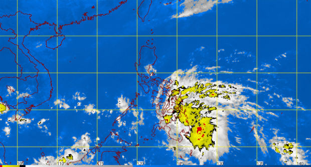
MT Satellite image November 26, 2014, 11:30 a.m. Screengrab from https://www.pagasa.dost.gov.ph/
MANILA, Philippines — Tropical depression Queenie is expected to make landfall over Surigao del Sur Wednesday afternoon, the state weather bureau said.
The cyclone was packing winds of 45 kilometers per hour near the center and was last observed 210 kilometers east of Hinatuan, Surigao del Sur, the Philippine Atmospheric Geophysical and Astronomical Services Administration (Pagasa) said in its 11 a.m. advisory.
Moving west at 24 kph, Queenie is expected to traverse Northern Mindanao by Wednesday night.
It is expected to exit the Philippine area of responsibility by Friday evening.
Queenie started out as a low pressure area (LPA) east of Mindanao and intensified into a tropical depression Wednesday morning.
Signal No. 1 was declared and remains over Southern Leyte, Bohol, Southern Cebu, Negros Oriental, Southern Negros Occidental, Siquijor, Surigao del Norte including Siargao Island, Surigao del Sur, Agusan del Norte, Agusan del Sur, Davao del Norte, Davao Oriental, Compostella Valley, Dinagat Province, Camiguin, Misamis Oriental, Misamis Occidental, Bukidnon and Zamboanga del Norte.

Pagasa said those in low-lying and mountainous areas of the provinces under Signal No. 1 should watch out for flashfloods and landslides.
Fisherfolk and those with small vessels are advised not to venture ino the eastern seaboard of the Visayas and Mindanao.
Meanwhile, the Bicol and Davao regions and the rest of Eastern and Central Visayas will have light to moderate rainshowers and thunderstorms, Pagasa said.
It added that Metro Manila and the rest of the country will be partly cloudy to cloudy with isolated rainshowers or thunderstorms.
RELATED STORIES
The risks PH faces due to climate change
Originally posted: 8:19 AM | Wednesday, November 26th, 2014