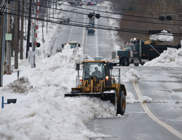
A front loader clears snow from Lake Avenue on Sunday, Nov. 23, 2014, in Orchard Park, N.Y. Western New York continues to dig out from the heavy snow dropped this week by lake-effect snowstorms. AP
BUFFALO, New York — Fears of disastrous flooding from a rapid meltdown of the Buffalo area’s historic snowfall eased on Monday, but high winds became a menace, threatening to knock down trees and power lines.
Forecasters, meanwhile, defended the National Weather Service following criticism from Gov. Andrew Cuomo, who accused the agency of failing to anticipate how bad Buffalo’s epic snowstorm would be.
Cuomo, in the region for a sixth straight day, said state-deployed pumps and sandbags were in place as rain and temperatures over 60 (16 Celsius) rapidly melted the snow. Residents shoveled snow in T-shirts against the backdrop of white drifts.
By late morning, minor to moderate flooding was reported in several creeks, but nearby homes were largely spared, and the sewers in Buffalo and elsewhere were handling the runoff.
The snowfall across the Buffalo area reached up to 7.5 feet (2.3 meters), depending on where the bands of snow coming off Lake Erie hit hardest.
Forecasters said the potential for flooding remained through Wednesday morning.
The new threat, he said, was wind — gusts up to 65 mph (105 kph), with the potential to uproot trees from the soggy ground and knock out power needed to operate homeowners’ basement sump pumps.
At a news conference, the governor said he hadn’t intended to upset forecasters when he said over the weekend that the weather service was “off” on its predictions for the storm.
Most snow-affected school districts remain closed Monday, and at least four called off classes for the entire Thanksgiving week.
RELATED STORIES
Pagasa watching low pressure area east of Mindanao
Disaster risk reduction is everybody’s business