MANILA, Philippines—The generally good weather in most parts of Luzon is expected to last until the weekend after a low pressure area east of Surigao City dissipated as it drew closer to the country’s land mass on Wednesday.
A convergence of the amihan or northeast monsoon and the easterlies is expected to bring light to moderate rains over the Visayas and Mindanao.
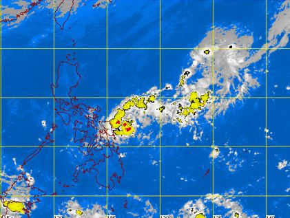
The Philippine Atmospheric, Geophysical and Astronomical Services Administration said that while Luzon might have isolated light rains, weather conditions will generally be fair for the region toward the weekend.
Forecaster Fernando Cada said Pagasa was not monitoring any new weather disturbance after the low pressure area, last tracked 605 kilometers east of Surigao City, dissipated before noon Wednesday.
According to Cada, while the amihan is prevailing over northern and Central Luzon, the convergence of northeasterly and easterly winds over the Visayas and Mindanao could bring light to moderate rainshowers and thunderstorms to some parts of those two places.
According to Pagasa’s forecast for Thursday, the Eastern Visayas and Bicol region will have cloudy skies with light to moderate rainshowers and thunderstorms.
The regions of Central Luzon, Cagayan Valley, and Ilocos as well as Metro Manila and the Cordillera Administrative Region will have partly cloudy to at times cloudy skies with isolated light rains while the rest of the country will be partly cloudy to cloudy with isolated rainshowers or thunderstorms.
Moderate to strong winds will prevail over Luzon and the Visayas where coastal waters will be moderate to rough.
Elsewhere winds will be light to moderate with slight to moderate seas.