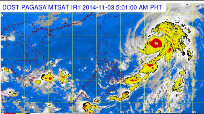
Typhoon ‘Paeng’ heads for exit

But because of its distance, Paeng is not expected to affect the country until it exits the PAR Tuesday afternoon, according to the Philippine Atmospheric Geophysical and Astronomical Services Administration (Pagasa).
The 19th tropical cyclone to enter the country this year will continue to enhance the northeast monsoon and bring light to moderate rainshowers and thunderstorms over Palawan, Bicol, Eastern Visayas and Mindanao.
Isolated light rains are expected over Cagayan Valley, Cordillera and Ilocos while the rest of the country, including Metro Manila, can expect isolated rainshowers or thunderstorms, Pagasa said.
However, Paeng caused warnings of rough to very rough seas in the eastern seaboards of Luzon, the Visayas and Mindanao, Pagasa said, as it advised fishermen and small vessels against going out to sea.
As of 4 p.m. Sunday, the eye of the typhoon was 1,120 km east of Casiguran, Aurora.
Article continues after this advertisementIt swerved further away from land as it moved northward at 13 kph toward Japan.
Pagasa said Paeng would be about 1,290 km east of Itbayat, Batanes, by Tuesday morning, and will be out of the PAR by Tuesday afternoon.–Dona Z. Pazzibugan
Responding to appeals for help, the Inquirer is extending its relief efforts to the families affected by Typhoon Paeng. Cash donations may be deposited in the Inquirer Foundation Corp. Banco De Oro (BDO) Current Account No.: 007960018860 and through Maya
