
pagasa.gov.ph photo
MANILA, Philippines — The tropical storm that was forecast to enter the Philippine area of responsibility Friday night may not make landfall and head towards Japan, the state weather bureau said.
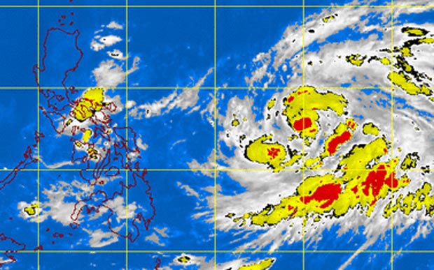
The storm, with international name “Nuri,” packed maximum sustained winds of 65 kilometers per hour near the center and gusts of up to 80 kph, the Philippine Atmospheric Geophysical and Astronomical Services Administration said.
It was last observed 1,255 kilometers east of Visayas and was moving west northwest at 15 kph.
Samuel Duran said “Nuri,” which will be locally named “Paeng” when it enters the PAR, was not likely to make landfall and instead head to Japan.
The northeast monsoon, meanwhile, is affecting Northern Luzon.
“Calabarzon, Bicol Region and Eastern Visayas will have cloudy skies with light to moderate rainshowers and thunderstorms. Cagayan Valley, Cordillera and Ilocos region will experience partly cloudy skies with isolated light rains. Metro Manila and the rest of the country will be partly cloudy to cloudy with isolated rainshowers or thunderstorms,” Pagasa said.