MANILA, Philippines—Although a weaker Typhoon “Ompong” (international name: Vongfong) exited the Philippine area of responsibility (PAR) on Saturday afternoon, the weather bureau has maintained its gale warning over Northern Luzon.

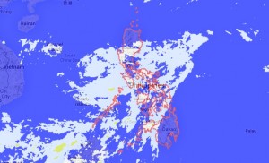
Source: Project Noah 09:01 am | October 12, 2014
Philippine Atmospheric, Geophysical and Astronomical Services Administration (Pagasa) forecasters said the typhoon’s continued enhancement of the northeasterly winds was bringing rough seas to Northern Luzon.
Forecaster Meno Mendoza said “Ompong” exited the PAR at 2 p.m. yesterday and was last spotted at 850 kilometers northeast of Itbayat, Batanes, with maximum winds of 165 kilometers per hour and gusts of up to 200 kph, moving north-northwest at 13 kph towards the southern part of Japan.
It was expected to slam into Okinawa last night as the strongest Pacific storm to make land so far this year.
Mendoza warned fishing boats and other small vessels against venturing out to the northern and eastern seaboards of Northern Luzon because of strong to gale force winds associated with the typhoon-enhanced northeasterly winds.
He alerted bigger vessels to waves that could reach heights of 4.5 meters.
In Pagasa’s forecast for Sunday, with the intertropical convergence zone prevailing over Southern Luzon and the Visayas, Metro Manila, Central Luzon, Calabarzon, Mimaropa, Bicol, the Visayas, Caraga, Northern Mindanao, the Autonomous Region in Muslim Mindanao, North Cotabato and the Zamboanga Peninsula will experience cloudy skies with light to moderate rain showers and thunderstorms.
The rest of the country will be partly cloudy to cloudy with isolated rain showers or thunderstorms.
Moderate to strong winds will prevail over the entire archipelago where coastal waters will be moderate to rough.
RELATED STORY
Powerful typhoon churns towards Japan after leaving PH