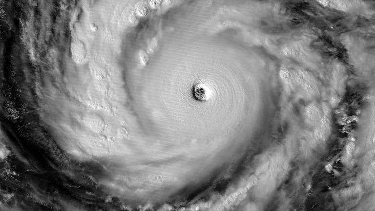
This image of Super Typhoon Vongfong using NASA’s Visible Infrared Imaging Radiometer Suite (VIIRS), obtained October 8, 2014 courtesy of NOAA/NASA/RAMMB/CIRA, shows the storm illuminated by moonlight. AFP
MANILA, Philippines—Super Typhoon “Ompong” (international name Vongfong) intensified further but slowed down on Wednesday afternoon.
The super typhoon packed maximum sustained winds of 215 kilometers per hour and gusts of up to 250 kph. It was now crawling west northwest at 9 kph, the Philippine Atmospheric Geophysical and Astronomical Services Administration said in its afternoon bulletin.
Ompong, the world’s strongest typhoon this year, was last observed 995 kilometers east of Tuguegarao City in Cagayan and continued to head towards southern Japan.
The super typhoon, expected to exit PAR on Saturday, will not have a direct effect on the country, Pagasa said.
The intertropical convergence zone continued to affect Visayas and Mindanao.
Metro Manila, Mimaropa, Calabarzon, Bicol region, Visayas, Zamboanga peninsula, ARMM and northern Mindanao will experience cloudy skies with light to moderate rainshowers and thunderstorms, Pagasa said.
Cagayan Valley, CAR and the provinces of Ilocos will have cloudy skies with light to moderate rains. The rest of the country will be partly cloudy to cloudy with isolated rainshowers or thunderstorms.
RELATED STORIES
Super Typhoon ‘Ompong,’ strongest this year, to spare PH
‘Ompong’ enters Philippines but won’t make landfall–Pagasa