MANILA, Philippines—Typhoon “Neneng” (international name: Phanfone) exited the Philippine area of responsibility (PAR) on Saturday morning, but the weather bureau is monitoring a new approaching tropical cyclone.

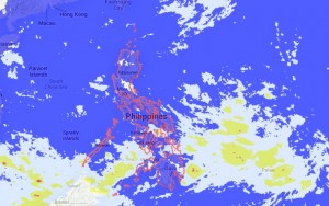
Source: Project Noah | October 5, 2014, 7:32 am
The Philippine Atmospheric, Geophysical Astronomical Services Administration (Pagasa) said that tropical storm “Vongfong” could take a track similar to “Neneng” and pass through the northeastern boundary of the PAR.
Pagasa forecaster Aldczar Aurelio said the new tropical cyclone was spotted over the Pacific Ocean east of the country but was still far from the PAR.
He said that it was possible “Vongfong” would follow Phanfone’s west-northwest path and would neither make landfall nor directly affect the country.
Typhoon “Neneng” left the PAR at around 5 a.m. Saturday and headed northwest for southern Japan. It had maximum sustained winds of 175 kph near the center and gustiness of up to 210 kph.
In Pagasa’s forecast for Sunday, the prevailing intertropical convergence zone over Southern Mindanao will bring cloudy skies with light to moderate rainshowers and thunderstorms over the Central Visayas, Zamboanga peninsula and Negros Occidental.
Metro Manila and the rest of the country will be partly cloudy to cloudy with isolated rainshowers or thunderstorms.
Moderate to strong winds will prevail over the northern and eastern sections of Luzon where coastal waters will be moderate to rough. Light to moderate winds will prevail over the rest of Luzon and the rest of the country with slight to moderate seas. Jeannette I. Andrade
RELATED STORIES
Weathermen watch new storm named ‘Vongfong’