Earthquakes destroy 15 houses in N. Cotabato
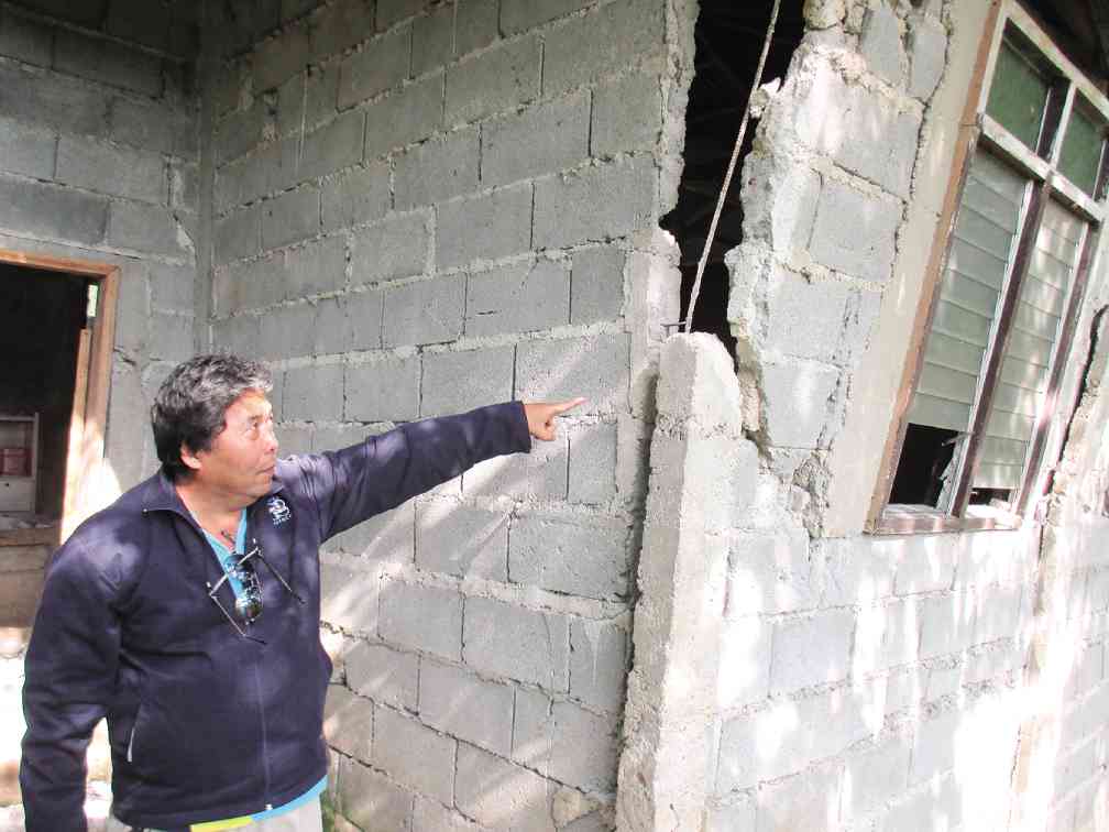
HERMES Daquipa, acting field observer officer of the Philippine Institute of Volcanology and Seismology, checks the houses damaged by a series of quakes in Barangay Luayon, Makilala town, North Cotabato province, on Saturday. WILLIAMOR A. MAGBANUA/INQUIRER MINDANAO
DIGOS CITY—For the second straight day, earthquakes jolted parts of Central Mindanao on Sunday, but these were relatively weaker than the previous ones.
The Philippine Institute of Volcanology and Seismology (Phivolcs) recorded two tremors—one with a magnitude of 3.1 at 12:13 a.m., which shook Kidapawan City and nearby areas, and the other at 12:37 a.m. with a magnitude of 3.4.
The epicenter of the first quake was traced at 26 kilometers southwest of Kidapawan at a depth of 20 km, while the second was shallower than the previous one at 12 km and plotted at 17 km southwest of the city.
No aftershocks or damage were expected, Phivolcs said. But on Saturday, the quakes, numbering over a dozen, destroyed 15 houses made of light materials and damaged more than three dozen other structures, including a chapel, in Makilala town, North Cotabato province.
Newly discovered fault
Article continues after this advertisementAll temblors were tectonic in origin.
Article continues after this advertisementHermes Daquipa, acting field observer officer of Phivolcs, said the tremors could have originated from a newly discovered fault in the Makilala-Colombio area.
“The Makilala-Colombio is not on the map of officially recognized distribution of faults and trenches of Phivolcs. This is the first time that it moved,” he explained.
The still unnamed fault system traverses from southwest of Barangay (village) Luayon in Makilala town to Colombio town in Sultan Kudarat province.
Daquipa, however, said there were no ground cracking and uplift. Further scientific studies should be done on the local fault, he added.
Earthquakes are a normal occurrence in the Philippines, which sits on the so-called Pacific Ring of Fire.
Dozens of earthquakes are recorded in the country each week, but some are too weak to be felt. One of the worst earthquakes was recorded on
Aug. 16, 1976, with a magnitude of 7.9. Triggering a tsunami, the quake killed between 5,000 and 8,000 people in the Moro Gulf region, including Cotabato and Pagadian cities. With a report from Allan Nawal, Inquirer Mindanao