‘Mario’ gains strength, rains to fall over Bicol, Eastern Visayas
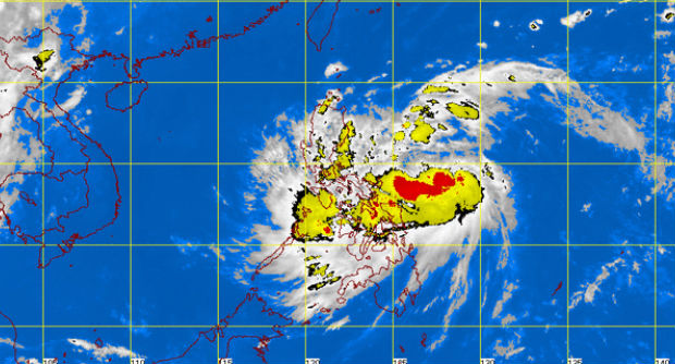
MT Satellite image September 18, 2014, 9:01 a.m. Screengrab from https://www.pagasa.dost.gov.ph/
MANILA, Philippines – From a tropical depression, “Mario” has gained strength off the seas of Visayas and is now a tropical storm, the weather bureau said.
In its weather forecast, the Philippine Atmospheric, Geophysical and Astronomical Services Administration said that Tropical Storm “Mario” was now packing maximum sustained winds of 65 kilometers per hour and gusts of 80 kph and was last spotted at 4:00 am at 460 km east of Catarman, Northern Samar.
Pagasa said that “Mario” has a pace of 28 kph and was taking a west northwest track.
“Mario” is not expected to make landfall on any part of the Philippines so no public storm warning signal is being raised, Pagasa said.
Bicol and Eastern Visayas will experience moderate to heavy rains and thunderstorms which may trigger flashfloods and landslides.
Article continues after this advertisementPagasa added that Metro Manila, the rest of Luzon and Visayas, the Zamboanga Peninsula, Northern Mindanao and Caraga would have cloudy skies with light to moderate rainshowers and thunderstorms.
Article continues after this advertisementMindanao and the rest of the country will have cloudy skies with isolated rainshowers and thunderstorms.
RELATED STORY
Classes in all levels suspended in Cebu due to floods