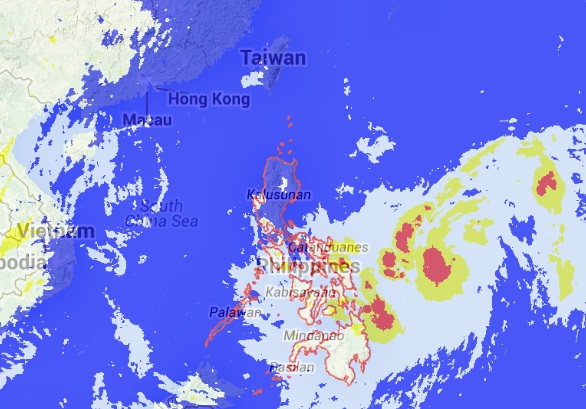
Satellite Image, September 17, 2014, 5:32 PM. SCREENGRAB from noah.dost.gov.ph
MANILA, Philippines—After Typhoon “Luis” pummeled parts of northern Luzon, a new tropical depression has entered the Philippine Area of Responsibility.
In its latest update, the Philippine Atmospheric, Geophysical and Astronomical Services Administration said that the tropical depression was named “Mario” and was spotted at 740 kilometers east of Borongan, Samar at 2:00 p.m. Wednesday.
Pagasa added that “Mario” packs maximum sustained winds of 45 kilometers per hour near the center moving west northwest at 24 kph.
Pagasa weather forecaster Buddy Javier said that “Mario” would not hop around the Philippine landmass as it would only graze the PAR on the eastern seas of Luzon and Visayas.
“Mario would not make landfall in the Philippines. If it maintains its speed and track it is expected to exit the PAR on Saturday afternoon,” Javier said.
Javier said that “Mario” is on track to hit southern Japan if it continues its movement.
RELATED STORIES
LPA outside of PAR may become cyclone, Pagasa says