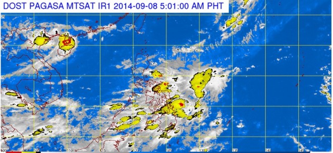
Philippine Atmospheric, Geophysical and Astronomical Services Administration (Pagasa) forecasters said Karding exited late Saturday night but it slightly enhanced the habagat, which is anticipated to spawn rains over the western sections of Luzon and the Visayas, as well as parts of Mindanao.
Forecaster Buddy Javier said the weather bureau was monitoring a low pressure area (LPA) last tracked at around 10 a.m. Sunday at 1,250 kilometers east of Mindanao.
Javier said the LPA had developed into a mere cloud cluster but still had not dissipated.
He said it could still develop into an LPA again and intensify into a cyclone as long as it was over the Pacific Ocean.
In Pagasa’s forecast for Monday, the Mimaropa, Western Visayas, Zamboanga peninsula, northern Mindanao, Caraga and Davao region will experience cloudy skies with light to moderate rainshowers and thunderstorms.
Metro Manila and the rest of the country will be partly cloudy to cloudy with isolated rainshowers or thunderstorms mostly in the afternoon or evening.–Jeannette I. Andrade