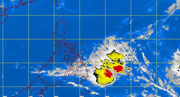
MANILA, Philippines – Tropical depression Domeng weakened into a low pressure area but will still bring rains, the state weather bureau said Thursday.
The LPA was last observed 350 kilometers east northeast of Hinatuan, Surigao del Sur, the Philippine Atmospheric Geophysical and Astronomical Services Administration (Pagasa) said.
The regions of Davao and Caraga, the province of Misamis Oriental and Eastern Visayas will have cloudy skies with scattered light to moderate rainshowers and thunderstorms, Pagasa said.
Metro Manila and the rest of the country will be partly cloudy to cloudy with isolated rainshowers or thunderstorms mostly in the afternoon or evening.
The highest temperature in Metro Manila on Wednesday was 32.8 degrees Celsius at 2:30p.m.
Moderate to strong winds blowing from the northeast to northwest will prevail over the eastern section of the country and its coastal waters will be moderate to rough.
Elsewhere, winds will be light to moderate coming from the northeast to northwest with slight to moderate seas.
RELATED STORIES
‘Domeng’ to make landfall in Samar Saturday – Pagasa
‘Domeng’ slows down; to linger for several days
