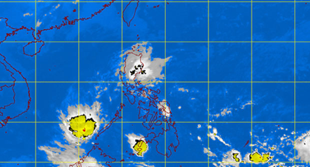
MANILA, Philippines—The low pressure area (LPA) within the country’s area of responsibility will no longer intensify into a tropical cyclone, the weather bureau said on Monday, but added that cloud bands sighted far east of Mindanao could develop into a weather disturbance.
Philippine Atmospheric, Geophysical and Astronomical Services Administration (Pagasa) forecasters expect the LPA, which earlier developed into Tropical Depression “Caloy,” to move out of the Philippine area of responsibility (PAR) by Tuesday afternoon.
Pagasa forecaster Jun Galang said that as of 4 p.m. Monday, the LPA was in the vicinity of Puerto Princesa City.
Galang told the Inquirer the weather bureau was monitoring cloud bands over the Pacific Ocean. “An LPA may form from those bands so we are closely monitoring them,” he said.
He said the convergence of the LPA or its trough with the northeasterly wind flow was anticipated to bring on Tuesday light to moderate rain showers and thunderstorms to Metro Manila, Central Luzon and southern Luzon, particularly Calabarzon, Bicol and Mimaropa.
According to Pagasa’s forecast for Tuesday, the Cordillera Administrative Region and the Cagayan Valley will have cloudy skies with light rains while the rest of the country will be partly cloudy to cloudy with isolated rain showers or thunderstorms.—Jeannette I. Andrade
