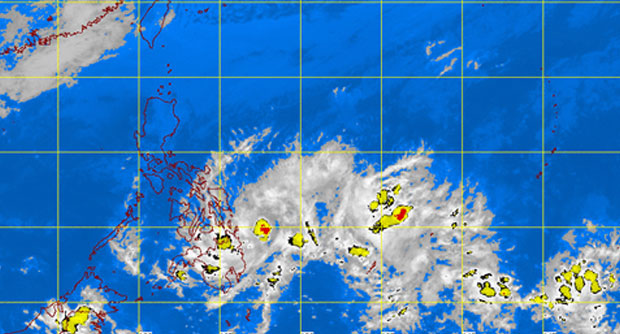
MANILA, Philippines—More areas in parts of Visayas and Mindanao were placed under Signal No. 1 as tropical depression “Caloy” moved closer to Surigao del Sur on Friday afternoon.
Caloy was last observed 310 kilometers northeast of Davao City or at 170 kilometers east northeast of Hinatuan in Surigao del Sur, the Philippine Atmospheric Geophysical and Astronomical Services Administration said.
Signal No. 1 was raised in: Southern Leyte, Bohol, Siquijor, Southern Cebu, Southen part of Negros Occidental, Southern part of Negros Oriental, Northern part of Davao Oriental, Northern part of Davao del Norte, Compostela Valley, Surigao del Sur, Surigao del Norte incl. Siargao, Dinagat, Agusan del Sur, Agusan del Norte, Bukidnon, Misamis Oriental and Camiguin.
Caloy packed maximum sustained winds of 45 kilometers per hour near the center. It was forecast to move west northwest at 15 kph.
Moderate to heavy rains were forecast within the 300 kilometer diameter of the tropical depression.
Fishing boats as well as other small secraft were advised not to venture out into the seaboards of Central Luzon and Eastern Visayas because of the northeast monsoon.
Meanwhile, Cagayan Valley and the province of Aurora will have cloudy skies with light rains. Metro Manila and the rest of Luzon will experience fair weather aside from isolated light rains.
Moderate to strong winds from the northeast will prevail over Luzon and coming from the northeast to northwest over the rest of the country, Pagasa said.
The coastal waters throughout the archipelago will be moderate to rough.
RELATED STORY
‘Caloy’ puts 12 Mindanao areas under Signal No. 1
