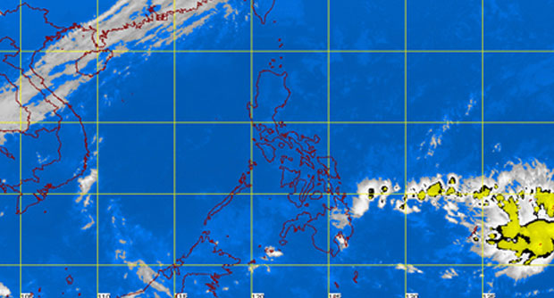
LPA expected to enter PH Tuesday evening onward
MANILA, Philippines—A low pressure area (LPA) over the Pacific Ocean is expected to enter the Philippine area of responsibility between Tuesday evening and Wednesday morning, the state weather bureau said.
This will bring rains over the Visayas and Mindanao but the chances of the LPA intensifying are slim, weather forecaster Cris Perez of the Philippine Atmospheric Geophysical and Astronomical Services Administration (Pagasa) told the INQUIRER.net Tuesday morning.
He said, though, that they were “not ruling out the possibility” that it would become a tropical depression, in which case it would be locally named Caloy.
Pagasa’s daily forecast said that moderate to strong northeasterly surface windflow is affecting the eastern sections of the country.
The northeast monsoon, which is bringing cold weather in extreme northern Luzon, is not completely gone and may return in the coming days, Perez said.
Article continues after this advertisement“The regions of Caraga, Davao and northern Mindanao will experience cloudy skies with light rains and isolated thunderstorms,” Pagasa said.
Article continues after this advertisementMetro Manila and the rest of Luzon will be partly cloudy to cloudy with isolated light rains. The rest of the country will have partly cloudy to cloudy skies with isolated rainshowers or thunderstorms.
Moderate to strong winds from east to northeast will prevail over Luzon and from the northeast over the rest of the country.
The coastal waters throughout the archipelago will be moderate to rough.
