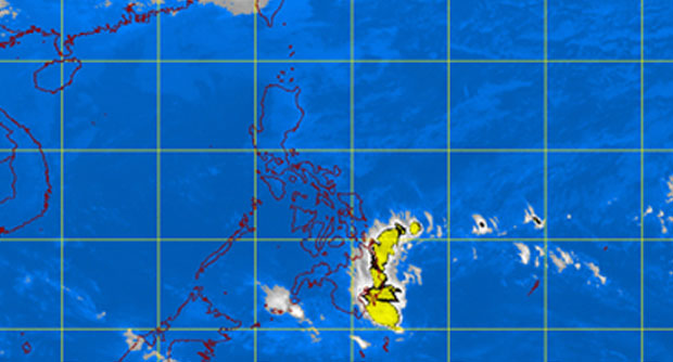
MANILA, Philippines—A low pressure area being monitored by the weather bureau was spotted off General Santos City on Tuesday morning.
The LPA was tracked 530 kilometers east of General Santos City, the Philippine Atmospheric Geophysical and Astronomical Services Administration (Pagasa) said in its early morning bulletin.
It said the LPA is not likely to intensify into a tropical depression.
The regions of Caraga and Davao will experience cloudy skies with light to moderate rainshowers and thunderstorms, Pagasa’s morning bulletin said. The rest of Mindanao will be partly cloudy to cloudy with isolated rainshowers or thunderstorms.
The regions of Cordillera and Cagayan Valley and the provinces of Aurora and Quezon will have cloudy skies with light rains, Pagasa said.
Metro Manila, the rest of Luzon and Visayas will experience partly cloudy to cloudy skies with isolated light rains, as the northeast monsoon continues to prevail over Luzon and Visayas.
Moderate to strong winds from the northeast will prevail over Luzon, Visayas and Eastern Mindanao and the coastal waters along these areas will be moderate to rough.
Elsewhere, winds will be light to moderate coming from the northeast with slight to moderate seas.
