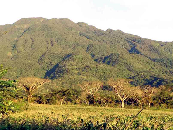
MT. ISAROG looms over the plains in suburban Naga City providing shelter for some of the Philippines’ endangered species while posing a threat to residents by upping the risk of flood. COURTESY OF ALEC SANTOS/NAGA CITY TOURISM OFFICE
A study conducted by the World Wide Fund for Nature (WWF-Philippines) showed that Naga City is second in vulnerability to calamities next to “Yolanda”-stricken Tacloban City among four cities studied.
Jose Ma. Lorenzo Tan, vice chair and chief executive officer of WWF-Philippines, said the multiyear study “Business Risk Assessment and the Management of Climate Change Impacts” was conducted to “examine economic and climate trends to predict and prepare for likely future scenarios.”
He said the study would provide guidelines for local governments and the private sector in strengthening communities against the effects of climate change.
Launched in 2011, the second phase included the cities of Tacloban, Naga, Angeles and Batangas in 2013.
Score
Naga City is prone to flooding induced by severe rains made serious by its location at the Bicol River Basin and Mt. Isarog.
“The city is said to be in danger of isolation during severe floods and its increased dependence on groundwater might pose as a danger to the health of its residents,” Tan said.
Data from the city database shows that the Bicol River Basin traverses Camarines Sur and Albay provinces. It crosses 41 municipalities.
Due to a rainfall rate of 1,600 to 4,300 millimeters per year, it has no pronounced dry season.
The river basin also lies within the main typhoon belt of the Philippines and experiences an average of 15-20 typhoons per year which causes it to swell and flood surrounding areas.
Mt. Isarog, meanwhile, is a potentially active stratovolcano which has an elevation of 2,000 meters above sea level.
Naga City shares Mt. Isarog with the towns of Goa, Tigaon, Ocampo, Pili, Calabanga and Tinambac.
More than 10,000 hectares of the volcano was declared a protected national park by the government in 2002 due to the existence of rare and endangered species of plants and animals there.
Both these land and water features were found by WWF-Philippines to be factors in the flooding of Naga City, thus raising its vulnerability.
Drainage
Tan advised that the city should start upgrading its drainage systems further to reduce its risks from floods.
He also advised the city to create alternative roads and rail routes while ensuring that the national highway that connects it with other regions “experiences zero downtime” even during calamities.
Mayor John Bongat clarified that although Naga City came out second to Tacloban City in terms of vulnerability, it does not mean the city is already the second most high-risk of all cities in the entire assessment.
During the past three years, Naga City started improving its drainage systems to minimize flooding.
Being the center of Bicol’s religious activities, Tan said the city has ensured that visitors would always flock to the city by improving its drainage and transportation.
City Tourism Office head Alec Francis Santos said the Bicol River Basin becomes a threat to Naga City only when heavy rainfall is coupled by high tide which further swells the junction between the Bicol and Naga Rivers.
He said the city government is also doing its best to preserve the forest cover on its side of Mt. Isarog to ensure that it would not contribute to more flood or landslides.
Tan said the city should start exploring other sources of water and not to become too dependent on groundwater as this might cause health problems and even shortages during calamities.
The installation of early warning systems should also be seen as a worthy investment for vulnerable cities, Tan said.
“We cannot continue simply relying on rehabilitation and relief because that is a never-ending struggle. The biggest investment should be made on preparedness,” Tan said.