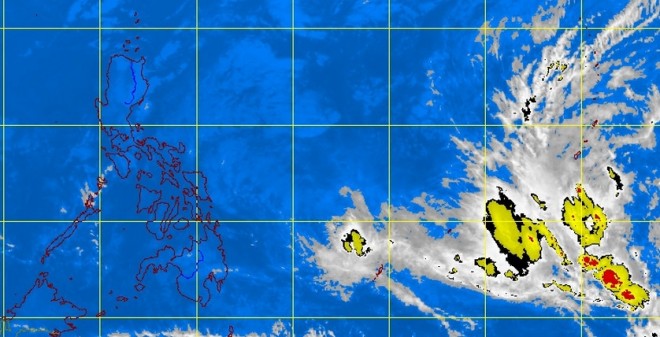
The weather bureau has spotted a low pressure area (LPA) some 2,500 kilometers east of northern Mindanao that could develop into a tropical cyclone once it enters the Philippine area of responsibility (PAR) in the next three to four days.
Philippine Atmospheric, Geophysical and Astronomical Services Administration (Pagasa) forecaster Jun Galang said the LPA was almost stationary due to its interaction with the tailend of the cold front over the Pacific Ocean. He said the weather bureau was closely tracking its movement.
Galang said that once the LPA starts moving westward and enters the PAR by Thursday or Friday, it could develop into a tropical cyclone that would be named “Basyang.”
The forecaster said the gale warning over the eastern seaboards of the entire archipelago remained in effect, with strong to gale-force winds associated with the surge of the amihan (northeast monsoon) making sea travel risky.
Galang advised fishing boats and other small seacraft against venturing into the eastern seaboards of Luzon, the Visayas and Mindanao, where sea conditions are expected to be rough to very rough. He also alerted larger vessels to waves that could reach up to 4.5 meters.
The Pagasa forecaster said Tuesday’s weather would remain generally cool and dry because of the amihan affecting Luzon and the Visayas.
The whole country will also experience partly cloudy to cloudy skies with isolated light rains on Tuesday, he added.—Jeannette I. Andrade
