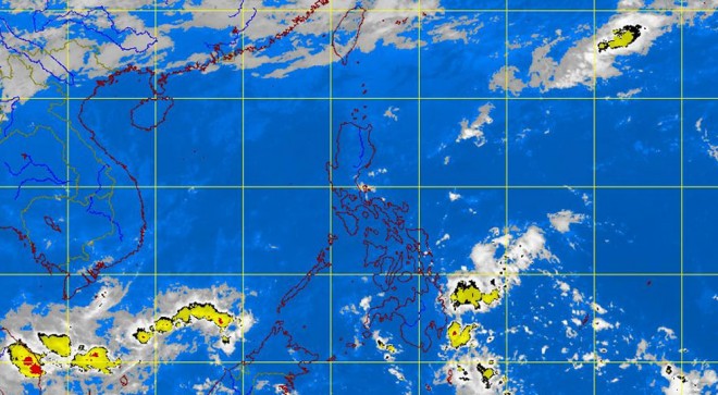
Rains in Central Luzon, eastern Mindanao on Tuesday—Pagasa
MANILA, Philippines—Rains are forecast for Central Luzon and eastern Mindanao, the state weather bureau said Tuesday.
A diffused tail-end of a cold front is affecting Central Luzon and a trough of low pressure area is affecting eastern Mindanao, the Philippine Atmospheric Geophysical and Astronomical Services Administration (Pagasa) said.
The provinces of Aurora and Quezon and the region of Caraga (Agusan del Norte, Agusan del Sure, Surigao del Norte, Surigao del Sur and Dinagat islands) will experience cloudy skies with light to moderate rainshowers and thunderstorms, the early-morning weather bulletin said.
Cagayan, Cordillera and Ilocos will be cloudy with light rains. Metro Manila and the rest of the country will have partly cloudy to cloudy skies with isolated rainshowers or thunderstorms.
Moderate to strong winds blowing from the northeast will prevail over Luzon. The coastal waters along these areas will be moderate to rough.
Elsewhere, winds will be light to moderate coming from the east to northeast with slight to moderate seas.
Fishing boats and other small seacraft were advised not to venture out into the sea while larger sea vessels were alerted against big waves as strong to gale force winds is expected to affect the northern seaboard of Northern Luzon, Pagasa said.
