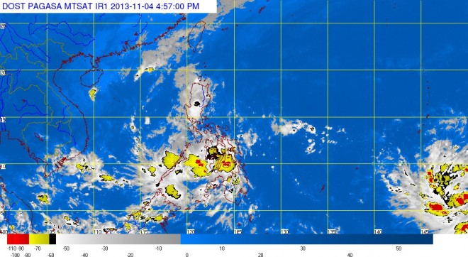
MANILA, Philippines — Tropical depression “Wilma” weakened into a low pressure area Monday afternoon hours after it made landfall in Surigao del Sur.
The low pressure area was last observed 32 kilometers southeast of Tagbilaran, Bohol, the Philippine Atmospheric Geophysical and Astronomical Services Administration said.
Wilma made landfall midday Monday in Tandag City, prompting several areas in Visayas and Mindanao to be placed under Signal No. 1.
But all storm signals were now lowered, Pagasa said.
Meanwhile, an intertropical convergence zone is affecting Visayas and Mindanao.
Pagasa said Visayas and the regions of Zamoanga Peninsula, Northern Mindanao and Caraga will have cloudy skies with moderate to occasionally heavy rains and thunderstorms which may trigger flashfloods and landslides.
Cagayan Valley, Mimaropa and the rest of Mindanao will have cloudy skies with light to moderate rainshowers or thunderstorms. Metro Manila and the rest of Luzon will be partly cloudy to cloud with isolated rainshowers or thunderstorms.
Moderate to strong winds blowing from the east to northeast will prevail over Luzon and Visayas and the coastal waters along these areas will be moderate to rough. Winds will be light to moderate coming from the east over Mindanao with slight to moderate sea.


