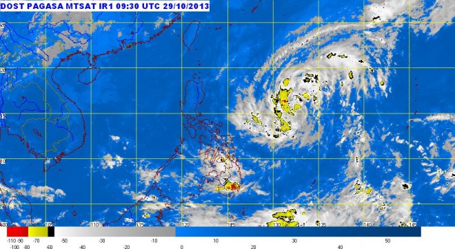
MANILA, Philippines — Tropical depression “Vinta” maintained its strength and approached Isabela-Aurora area Tuesday afternoon, the state weather bureau said.
Storm signal No. 1 (winds with 30-60 kilometers per hour) was raised in Isabela and Aurora, the Philippine Atmospheric Geophysical and Astronomical Services Administration said.
Vinta packed maximum sustained winds of 55 kilometers per hour near the center. It was forecast to move at 26 kph.
It was last observed 820 kilometers east of Virac in Catanduanes.
It is expected to exit by Friday morning.
Moderate to heavy rains were seen within the 300 kilometer-diameter radius of Vinta.
“Central and Eastern Visayas and Mindanao will have cloudy skies with light to moderate rainshowers and thunderstorms,” Pagasa said.
Meanwhile, Metro Manila and the regions of Ilocos, Cordillera, Cagayan Valley and Central Luzon will experience partly cloudy to cloudy skies with isolated light rains.
The rest of the country will be partly cloudy to cloudy with isolated rainshowers or thunderstorms mostly in the afternoon or evening.
RELATED STORY:
‘Vinta’ enters PH, may affect Metro Manila–Pagasa
