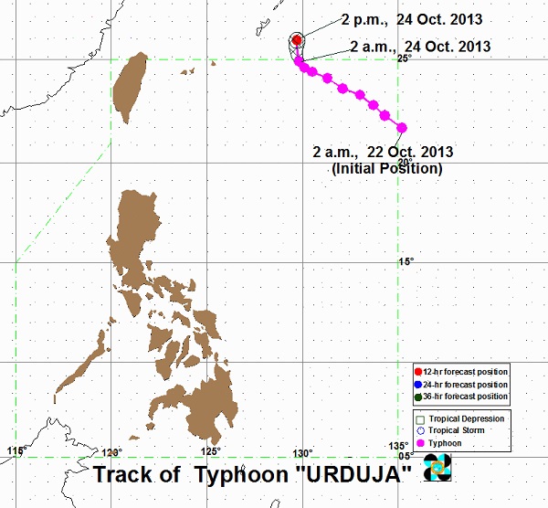
Typhoon ‘Urduja’ now out of Philippine area
MANILA, Philippines—A slightly weakened Typhoon Urduja left the country’s area of responsibility before dawn Thursday without much effect on the weather, except rendering sea travel risky off the northern and eastern coast of Luzon, the weather bureau said.
As of early Thursday, the eye of the typhoon was 855 kilometers northeast of Itbayat, Batanes, or 230 kilometers southeast of Okinawa, Japan, the Philippine Atmospheric, Geophysical and Astronomical Services Administration said.
Urduja (international name: Francisco) was packing winds of 130 kilometers per hour near the center and gusting up to 160 kph. It was moving northward at 9 kph.
Heavy to intense rain of 10-25 millimeters per hour was expected in areas coming within 350 kilometers of its eye or center.
Sea travel was risky off the coast Northern Luzon and the eastern coast of the rest of the Philippines’ largest island, Pagasa added.
Article continues after this advertisementAccording to Pagasa’s 24-hour weather outlook, the regions of Ilocos, Cordillera and Cagayan Valley would experience partly cloudy to cloudy skies with isolated light rains.
Article continues after this advertisementMetro Manila and the rest of the country would be partly cloudy to cloudy with isolated rain showers or thunderstorms, it said.
Moderate to strong winds blowing from the northeast to northwest would prevail over Luzon, and coastal waters would be moderate to rough.
Elsewhere, winds would be light to moderate coming from the northwest to west with slight to moderate seas, Pagasa said.
