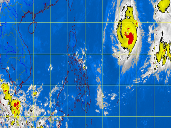
MT Satellite image October 21, 2013, Monday, 5:32AM. Screengrab from https://www.pagasa.dost.gov.ph/
MANILA, Philippines – Northern and Central Luzon will experience rains due to the northeast monsoon, the state weather bureau said Monday.
“Metro Manila and the regions of Ilocos, Cordillera, Cagayan Valley and Central Luzon will experience partly cloudy to cloudy skies with isolated light rains,” the Philippine Atmospheric Geophysical and Astronomical Services Administration said.
Meanwhile, the rest of Luzon, Visayas and Mindanao will be partly cloudy to cloudy with isolated rainshowers or thunderstorms mostly in the afternoon or evening.
Moderate to strong winds blowing from the northeast will prevail over Luzon and its coastal waters will be moderate to rough. Elsewhere, winds will be light to moderate coming from the northeast to northwest with slight to moderate seas.
Lowest temperature in Metro Manila on Sunday was at 22.7 degrees Celsius at 5a.m. Cooler temperature was forecast as the onset of northeast monsoon or hanging “amihan” was declared last week.
The typhoon expected to enter the Philippine area of responsibility with an international name “Francisco” was forecast to enter by Monday evening or early Tuesday.
Ben Oris of Pagasa said that the typhoon would pass through the tip of extreme Northern Luzon briefly as it heads towards Japan.
It will be locally called “Urduja” if it enters PAR. It was not expected to make landfall.