Pagasa warns vessels of strong winds

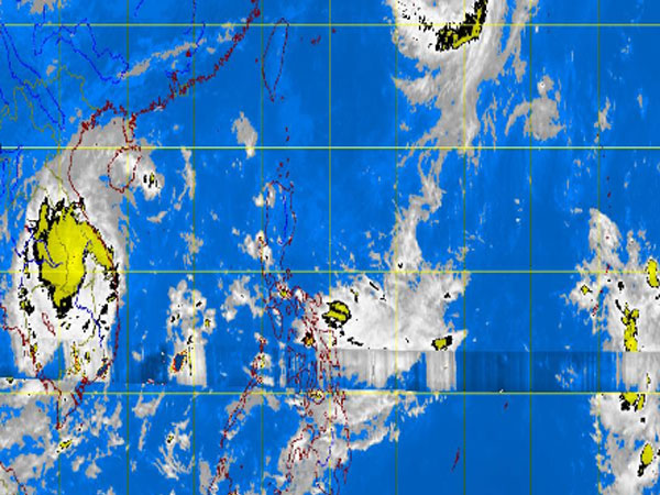
MT Satellite image October 16, 2013, Wednesday, 5:32AM. Screengrab from https://www.pagasa.dost.gov.ph/
MANILA, Philippines—Although typhoon “Tino” exited the Philippine area of responsibility (PAR) early Tuesday, the state weather bureau cautioned vessels against strong to gale force winds on the northern and eastern coasts of northern Luzon.
Forecaster Joey Figuracion said that under the gale warning, fishing boats and other small vessels are advised against venturing out to sea while larger ships are alerted to big waves. The northern and eastern seaboards of northern Luzon are expected to be rough to very rough.
A slightly weaker Tino, with maximum sustained winds of 150 kilometers per hour near the center and gustiness of up to 185 kilometers per hour, left the country around 4 a.m. Tuesday, moving north-northeast at 20 kilometers per hour.
The Philippine Atmospheric, Geophysical and Astronomical Services Administration (Pagasa) also issued at 4 p.m. Tuesday a special weather forecast for the provinces of Bohol and Cebu, areas hardest hit by the magnitude 7.2 earthquake.
In Pagasa’s special weather forecast for Cebu and Bohol, cloudy skies with light to moderate rainshowers and thunderstorms are expected Wednesday while skies are expected to be partly cloudy with isolated rainshowers or thunderstorms on Thursday.