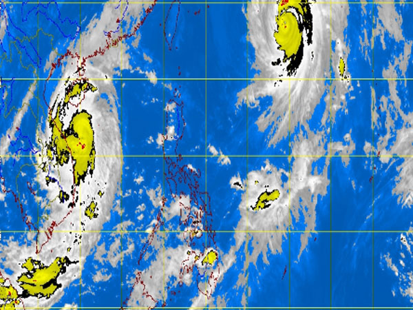
MT Satellite image October 15, 2013, Tuesday, 8:32AM. Screengrab from https://www.pagasa.dost.gov.ph/
MANILA, Philippines — Typhoon Tino (international name Wipha) slightly weakened as it made its exit from the Philippine area of responsibility early Tuesday, the state weather bureau said.
It was last observed 1,190 kilometers northeast of Basco Batanes, packing maximum sustained winds of 150 kilometers per hour near the center and gusts of up to 185 kph, the Philippine Atmospheric Geophysical and Astronomical Services Administration said.
It was forecast to move north-northeast at 20 kph.
Heavy to intense rains were still seen within its 700 kilometer-diameter.
An inertropical convergence zone is affecting Mindanao and will bring rains there.
Mindanao will experience cloudy skies with light to moderate rainshowers or thunderstorms, Pagasa’s bulletin said.
Meanwhile, the rest of the country will be partly cloudy to cloudy with isolated rainshowers or thunderstorms.
Moderate to strong winds blowing from the south to southwest will prevail over Luzon and its coastal waters will be moderate to rough. Elsewhere, winds will be light to moderate coming from the south to southwest with slight to moderate seas.