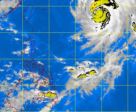
MANILA, Philippines — Typhoon “Tino” (international name Wipha) maintained its strength as it hovered near Batanes Monday afternoon.
It was last observed 1,190 kilometers northeast of Basco, Batanes with maximum sustained winds of 160 kilometers per hour and gusts of up to 190 kph, the Philippine Atmospheric Geophysical and Astronomical Services Administration said.
It continued to move north northwest at 20 kph.
The typhoon is not expected to affect the country and was forecast to exit Tuesday morning.
The whole country will experience partly cloudy to cloudy skies with isolated rainshowers or thunderstorms, Pagasa said.
Moderate to strong winds blowing from the north to northwest will prevail over northern and Central Luzon and coming from the southwest to west over the rest of Luzon. The coastal waters along these areas will be moderate to rough. Elsewhere, winds will be light to moderate coming from the southwest to west with slight to moderate seas.
