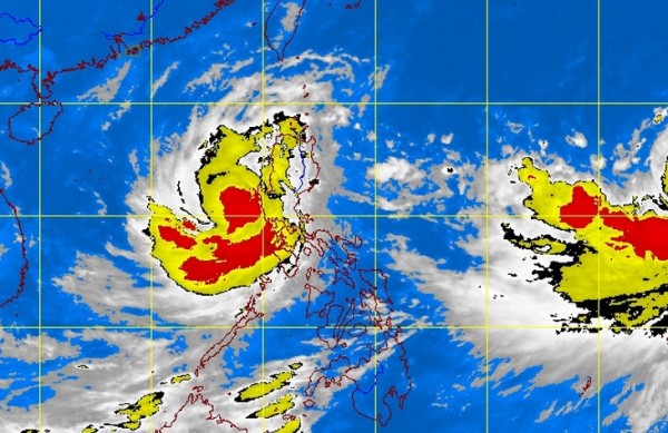
MANILA, Philippines—Typhoon Santi (international name Nari) has slightly weakened after making landfall over Aurora and was over the West Philippine Sea on Saturday morning.
The typhoon was already out of Philippine landmass and was forecast to exit the Philippine area of responsibility by Sunday morning, Remy Liwanag of the Philippine Atmospheric Geophysical and Astronomical Services Administration told INQUIRER.net, adding that the weather will improve starting Sunday.
Santi made landfall before midnight on Friday in Dingalan, Aurora.
The following areas remained under storm signals, according to Pagasa:
Signal No. 3
Zambales
Pangasinan
Signal No. 2
La Union
Benguet
Tarlac
Pampanga
Bataan
Signal No. 1
Ilocos Sur
Mt. Province
Ifugao
Nueva Viscaya
Quirino
Aurora
Nueva Ecija
Bulacan
Metro Manila
Rizal
Cavite
Laguna
Batangas
Lubang Island
Santi was last observed over the West Philippine Sea or 40 kilometers west of Iba, Zambales. It packed maximum sustained winds of 120 kilometers per hour and gusts of up to 150 kph.
It was moving west at 22 kph.
Sea travel remained risky over the seaboard of Luzon and of Visayas. Heavy to intense rains were seen within the 400 kilometer-diameter of the typhoon.
Meanwhile, tropical cyclone Wipha, which would be called “Tino” once it enters PAR, was expected to enter the country by Saturday night or Sunday morning, Liwanag said.
It was heading towards Japan and would not directly affect the country, she added.
RELATED STORIES:
Typhoon Santi makes landfall in Aurora
